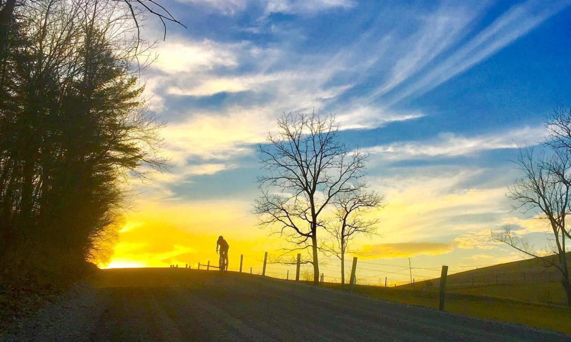

I’ve had my eye on the Allegheny Front Trail (AFT) lately. I’m not sure why it in particular has garnered my attention over all the other great central Pennsylvania hiking trails — maybe it’s the proximity to Evan’s new workplace and our general newly found interest in the Black Moshannon area, maybe it’s its attainable length (42 miles), maybe it’s the fact that it’s different from a lot of the other area long-distance trails. It’s less rocky, and on a plateau rather than ridgetops. There is plenty of elevation gain, but in a rolling manner rather than straight up and down. It traverses a variety of terrain and habitats. Whatever it is, I’m now on a mission to explore every mile of it, and then do it all in one day. While it is by no means an easy trail, it is less punishing than others in the area, and a perfect gateway to ultra trail running/hiking.
I’ve run sections of it in the past, biked a little of it (only a small portion is bike-legal), and cross-country skied some of it, but all my previous explorations amounted to less than a third of the trail in total. After some time with the Purple Lizard Map, it wasn’t long before I had a plan to complete all the remaining sections of trail in three excursions before my one-go attempt.
I had the day off work this past Monday, and weather looked prime for a long day in the woods. Evan had to work, so I came up with the brilliant idea to have him drop me off on his way in, and I’d see how far I could travel on foot in 8 hours. My focus was to be on the western side of the trail, which is a little harder to access and thus perfect for an all-day adventure that I don’t get the opportunity for too often. And, the access was directly on the way to Evan’s work, so it was convenient for both of us. More trail time for me, less drive time for him. While shooting the shit in the workshop over beers last week, my friend Ryan caught wind of the plan.
You wanna go? I asked.
He thought for a minute, then nodded an affirmation. Now there were two.
The morning of our adventure, Evan dropped us off on Hannah Furnace Road, just off 322. We deliberated about our gear for a minute — Ryan tested out the snow depth and crunchiness for footwear choices and I waffled about bringing an extra layer. He stuck with his lighter hiking shoes and I left the layer. Evan pulled away. Here we go.

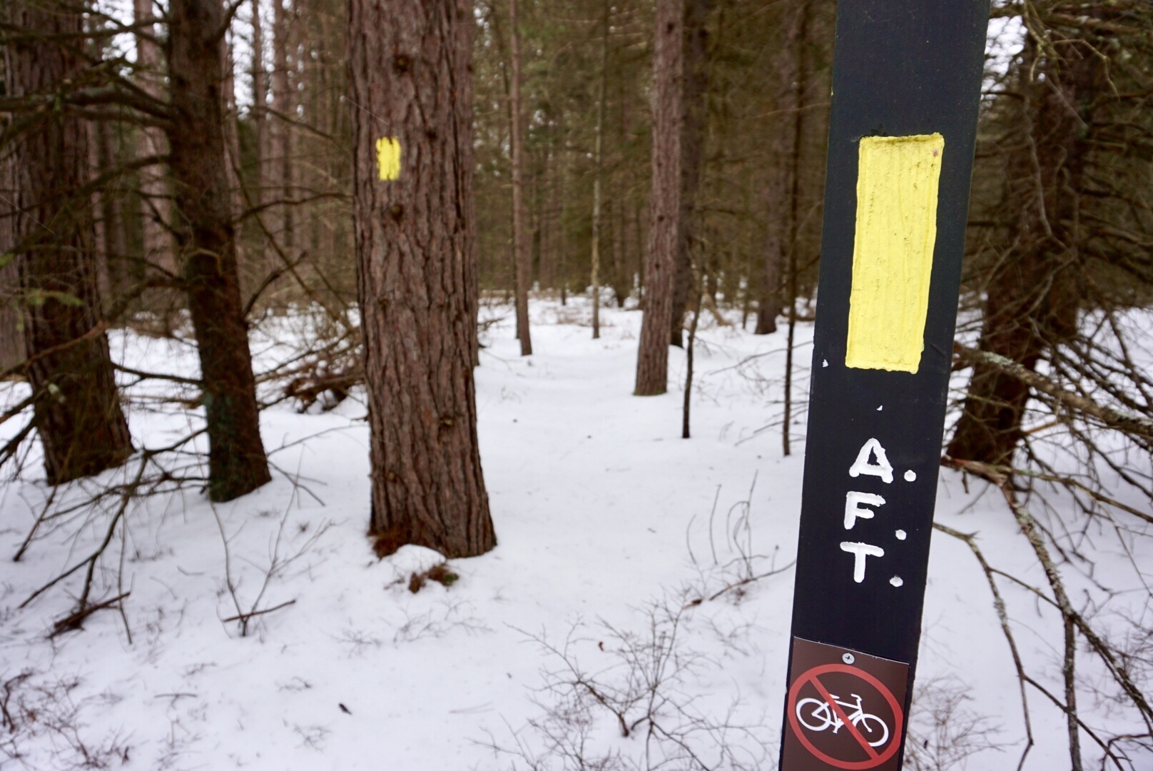
After close to a mile on the road we found a spur of the AFT called Slide Hollow Trail. It took us to an area that was recently logged, and we lost the trail but easily followed logging roads in what we knew was the right direction. It wasn’t long before we spied yellow blazes again, and we were back on track.
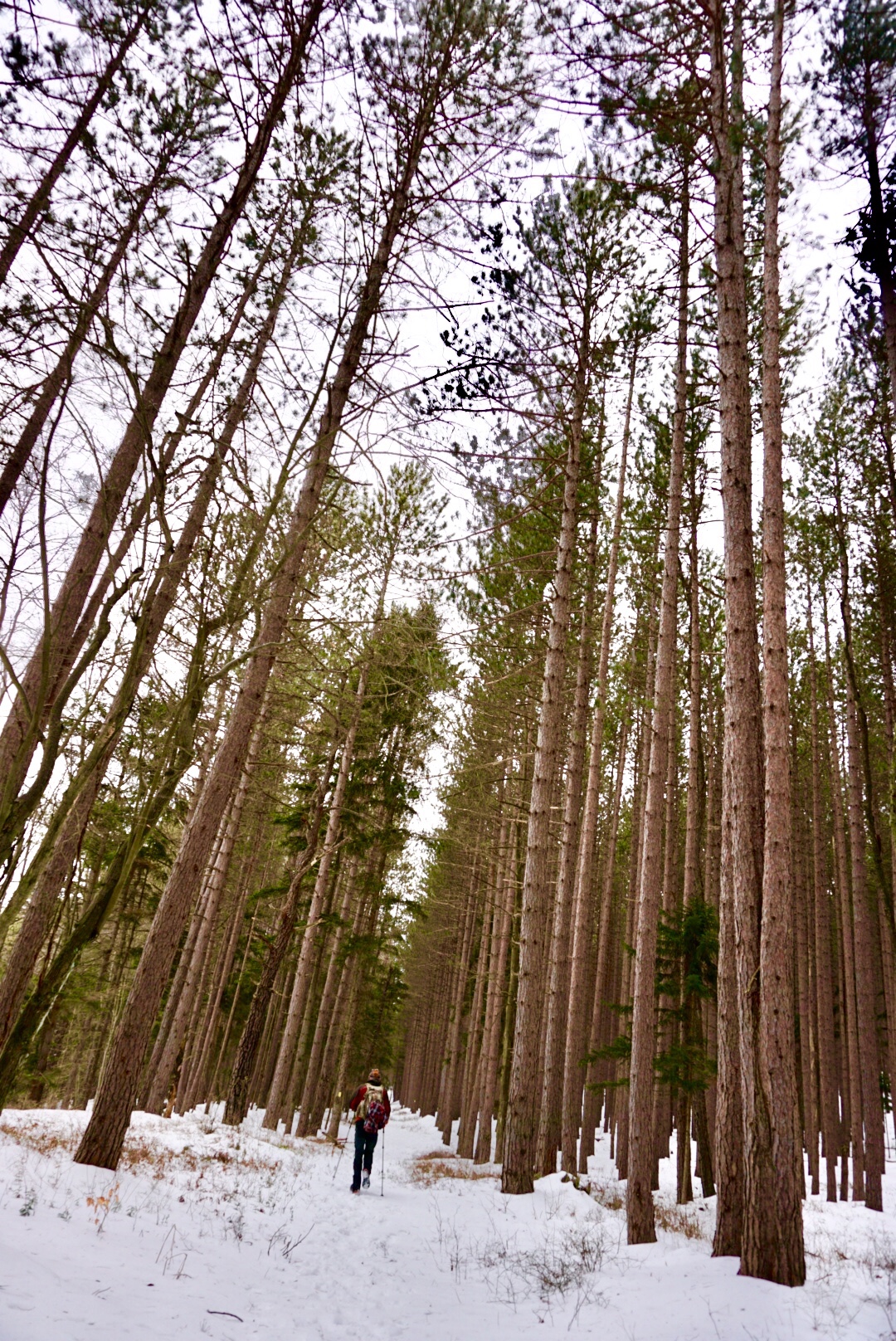
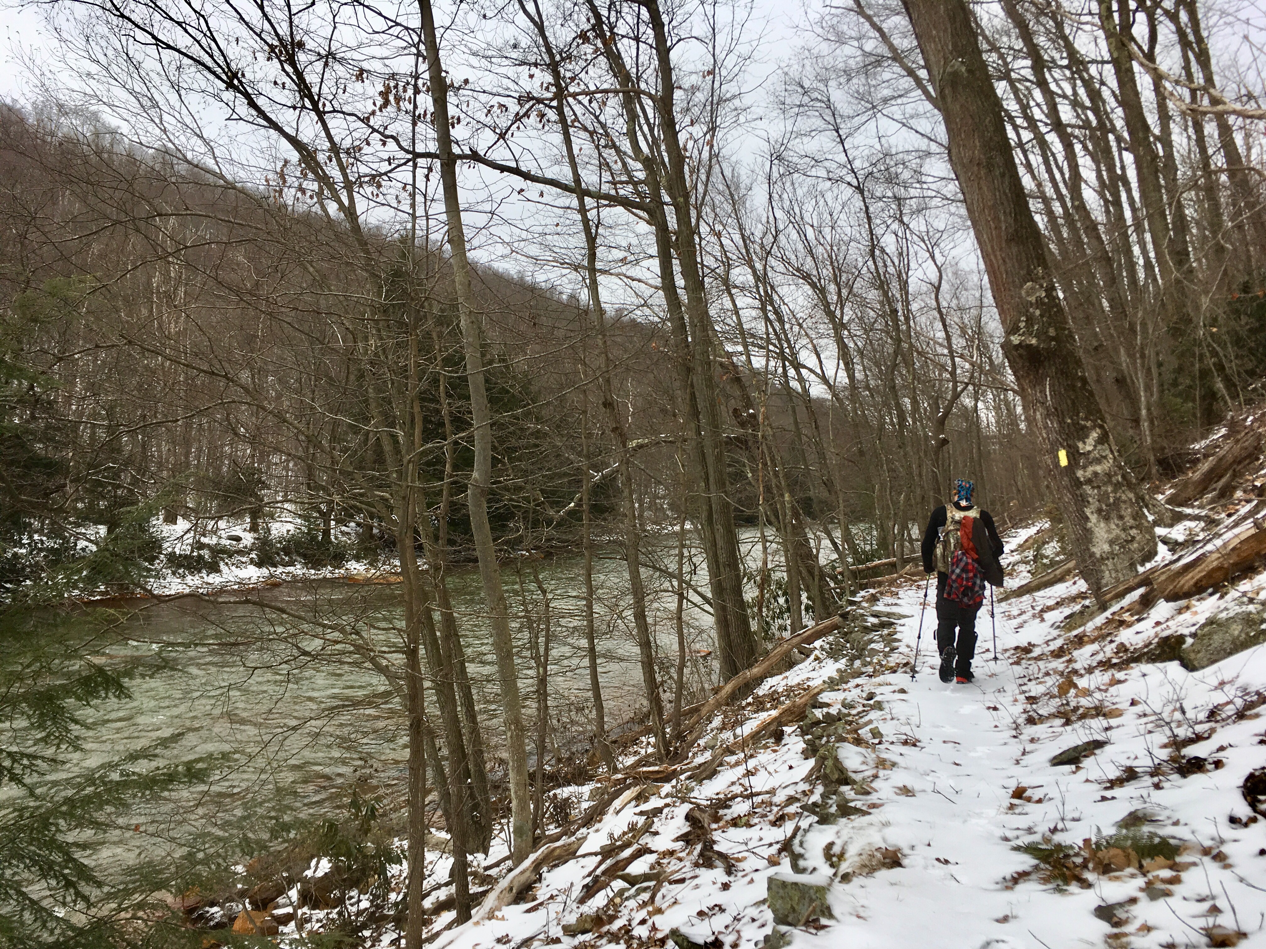
The first few miles were mellow and rolling. Once we left the logging operation behind, we found ourselves in deciduous and then pine forests, with trunks straight and tall, reaching for the sky. Six Mile Run babbled below, but we were a hundred feet or so above the water on the hillside. We crossed Shields Dam Trail, a doubletrack snowmobile trail, several times before ducking into rhododendron and then emerging on Route 504.

After crossing the pavement, the trail hugged the stream closely, so much so in spots that we were only inches away. It crossed through pools of standing water several times, and I resigned my feet to being wet. I had a pair of extra socks along, and I told myself that I could change them once we made it halfway.
Several miles later, we crossed Casanova Road. Just after the crossing, I became a little too confident on the off-camber trail and lost my footing on the ice, sliding down the bank a few feet before catching myself on a tree. I needed Ryan’s help to crawl back up, but no harm was done. I’d do something similar several more times before the end of the day, but luckily none of the incidents resulted in injury.

We’d gotten snow and then freezing rain the week before, and before that we’d had several freeze-thaw cycles that left a layer of granular, crusty snow on top of a sheet of ice. I was wearing trail running shoes that Evan had studded for me using Grip Studs, which have been great for running on icy sidewalks or when there isn’t much on top of the ice, but are no match for the strange mix of textures. There were quite a few instances when I wished that I’d just worn my hiking boots so that I would have more of a hard toe and beefier sole to dig into the crust, but by the end of 20 miles I was still 60/40 on my shoe decision, in favor of the running shoes. I like having light feet.

Six Mile Run eventually gave way to the mighty Red Moshannon, and we began to hear the steady hum of trucks on I-80, a sign that we getting close to Potters Point, where the trail shifted directions and we’d start to make our way southward towards Black Moshannon State Park and the terminus for today’s adventure.
The climb to Potter’s Point was the biggest of the day, but was still fairly mellow by Central PA standards. The Point itself was littered with big boulders, but the visual of a towering bridge and sounds of the highway interfered with the otherwise-remote feeling and caused it to feel a little underwhelming. Still, it’s a beautiful part of the world.

On top, the trail followed a grassy doubletrack path to where it crosses a gravel road, and the relative ease of walking was a welcome break from the uneven snow and icy rocks. A snack had renewed energy in us both, and we chatted enthusiastically as we hiked. At the road, we had to make a decision: continue along the trail or save some time and hammer out the last few miles on the road. We’d discussed this option earlier when we weren’t sure if we’d be able to complete the full 20 miles within the 8 hours before Evan came to pick us up, but we still had plenty of time left. We settled on the trail.
The next section dropped steeply to Black Moshannon Creek, and traction was hard to come by. Efforts to control the downhill slide were mostly futile, and it was easier to just let loose and trust that my legs would keep me upright. I ran down the hill, bouncing and whooping. At the bottom, we signed the trail register and left the AFT in favor of Shingle Mill Trail, which would take us back to the park.

The last couple of miles were cold. Our pace had slowed with tired legs and sore feet, and the temperature was distinctly dropping. Ryan had been pointing out tracks we saw in the snow all day — bobcat, coyote, black bear, turkey, rabbit, fox, beaver. We saw fresh blood from a recent kill. We heard wood ducks taking off as they sensed our presence. However, we barely saw any fauna with the exception of some deer. It was eerily quiet in the woods, all the animals hunkered low against winter, steering clear of our path. But while we couldn’t see them, we were probably watched by many eyes throughout the day.

The timing of our finish couldn’t have been more perfect. As we walked across the parking lot at the beach, our designated meeting spot, Evan pulled in with beers for us both and an eagerness to hear about our adventure. We excitedly told our stories, and my excitement carried over into the next day. A week and a half later, I’m still buzzing, and can’t wait to explore the next section.


Oh, H, that porcupine bark-snackin’ photo is SO GOOD!
LikeLiked by 1 person
Right?!? Love it!
LikeLike
Sounds fantastic. The forest looks so different from Michaux State Forest (where I live – Southern PA). Everything is very dense and closed in. Not much in the way of vistas.
LikeLike
One of the appeals of the Black Moshannon area is definitely that it’s so different. It’s way different than Rothrock State Forest, where I spend most of my time. I’ve been wanting to make it down to Michaux… hopefully this year!
LikeLiked by 1 person