
This story was getting long, so I broke it into multiple parts. Part 1 discusses my impetus for this ride as well as my bike and gear. Read it here if you missed it, and here’s my route.
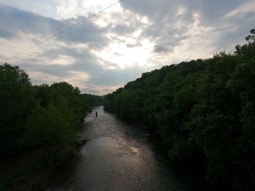
The sun had come out just in time for me to start riding. Surely this was a good sign. I wound my way around The Point, across the Fort Pitt Bridge, and past the Duquesne Incline, familiar scenes from a couple days prior, when we led 50+ conference attendees on a bike ride. I’d chosen to leave the city this way because it was fresher in my head than the detour around a closed section of the Great Allegheny Passage (GAP). City riding makes me anxious, particularly if I’m not entirely sure where I’m going.
On the South Shore, I weaved through clusters of teenage girls clad in bedazzled denim and sequins, in town for the Taylor Swift concert. They were mostly oblivious to me as I whizzed by, too wrapped up in their quest for the perfect selfie against the Pittsburgh skyline.

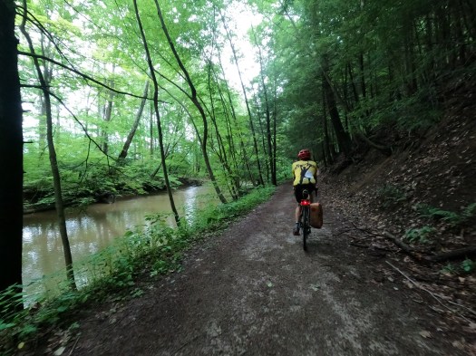
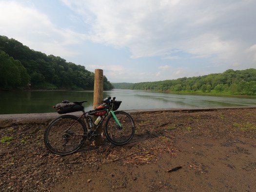
The South Side Trail met up with the GAP at the Hot Metal Bridge, where the GAP crossed from the eastern to the western shore of the Monongahela River. The section from here southward was new to me. Flanked by the river and a steep embankment, it was quieter and felt more isolated. I passed a couple other cyclists as I cruised southward towards the Rankin Bridge, where I was supposed to meet John. Naomi had introduced us and John had given me intel on the section of the route between the GAP to the Westmoreland Heritage Trail (WHT) as it was part of his regular commute and he knew it well. Then it turned out that he could leave work early and meet me to ride with me through that section, an offer that I couldn’t turn down. It was the only part of the route that I felt nervous about, and it would be nice to have company and a guide.


I saw a cyclist stopped along the trail ahead. As I grew closer, he waved at me with a big smile on his face. I slowed down. Are you John?
We exchanged hellos and quickly kept rolling, pedaling side by side and chatting away. Conversation came easy and despite coming off three days of conferencing and socializing, it was nice to have company. There would be plenty of alone time over the next 150 miles.
He was an excellent guide. Once we left the GAP at the Rankin Bridge, the route became a bit more tricky to follow, but John was always conscientious about giving me a heads-up about what we were going to do next. There were spots where we snuck along roadways via dirt trails or in the grass, nuances that would be hard to follow on a GPX route, and I trusted his moves as we maneuvered through traffic.
There were really only a couple truly sketchy sections of road — mostly crossings, such as getting onto the Rankin Bridge, and riding on Routes 48 and 130 near Trafford. Many of the other roads were actually fairly low-volume, had a low speed limit, or otherwise felt reasonably safe. But this section would have taken me a lot longer on my own because of my own lack of confidence when it comes to riding in urban and suburban areas.
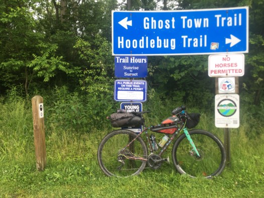
In Trafford, we made a left on the Westmoreland Heritage Trail. The WHT was quieter and more scenic than I expected. Given its location near what I call the “suburban hell” of Monroeville and Murrysville (to be fair, my experience of these places is mostly what I pass on Rt. 22), I thought it would be more open, busy and noisy. But instead, in a valley nestled against the banks of Turtle Creek, it was calm and peaceful. I didn’t even notice when we crossed under Rt. 22. We saw a great-blue heron, which John said was always there, in the same spot.
How much time do you have? John asked me when we reached Duff Park. I’m not in a hurry, I replied. I’d just like to get to Dilltown by dark. And even if I don’t, I have lights.
When I created the route and dreamt up this ride, I originally wanted to try to do it in one day. But the logistics and timing were such that if I was going to take advantage of this opportunity, it made more sense to do as an overnight, since I couldn’t leave Pittsburgh until after noon on Friday. I could push through and finish the last half in the dark, but I didn’t want to. That wasn’t what this trip was about for me. I wanted to be able to enjoy the scenery, check out all these trails and new-to-me roads, and take my time.
At Duff Park, we deviated from the WHT and instead took a rolling, dirt path along the creek. This is a nicer way to go, John told me. The other trail just goes past some businesses and was more open, but they are about the same distance. The doubletrack was fun and swoopy, for sure the more enjoyable route.
In Export, we had to jump back on roads for about 5 miles to bridge a gap in the WHT, but they weren’t bad traffic-wise or otherwise. As we were climbing towards Delmont, I looked behind me and saw dark grey skies. I think we may get some of that weather, I remarked.
The clouds let loose when we were back on the trail, but the shower was brief — five minutes at most. If anything, it was a welcome cool-down and added some extra excitement and interest to the ride. There are advantages and disadvantages to every season of riding, but the thing I love most about summer is that it’s warm enough that getting wet is inconsequential and there is a lot less thought that needs to go into riding apparel and gear choices.
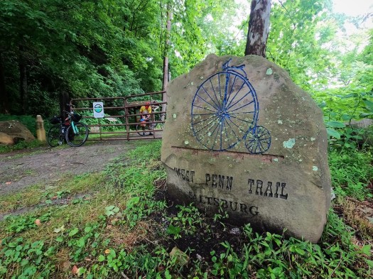
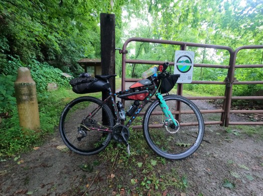
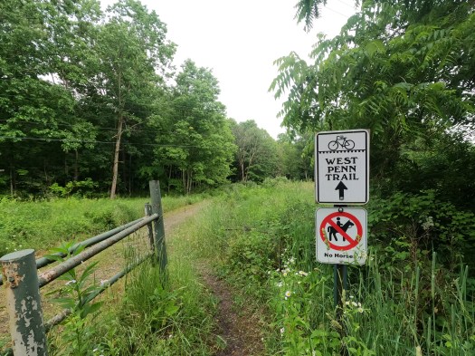
The WHT seamlessly connected into the West Penn Trail in Saltsburg. This was one of the sections of the ride I was most excited about. I’d heard that the West Penn is anything but a typical rail trail. It has sections of smooth and flat, but there are also sections that are more reminiscent of singletrack as well as some steep hills and even a hike-a-bike section.
We stopped for a quick snack at the entrance to the West Penn, both John and I a bit amazed that we hadn’t seen more people out on any of these trails so far today. Maybe the storms in the weather forecast had scared everyone off. Later, we’d see a couple folks out, but we mostly had the trail to ourselves.
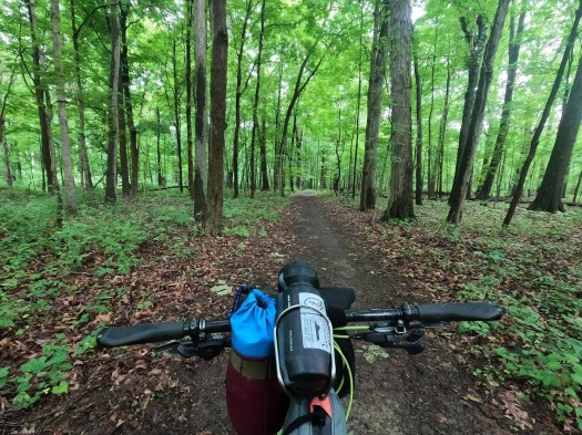
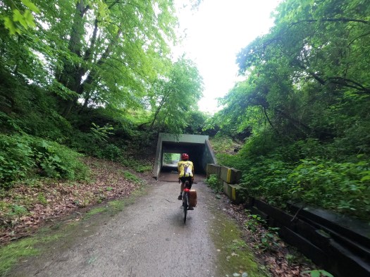
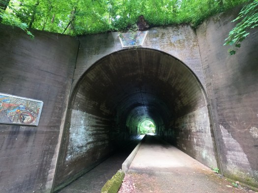
The first few miles from Saltsburg east were flat as we hugged the Conemaugh River, but soon we entered what is known as the Dick Mayer section through State Game Lands 328. The trail narrowed in spots, and had plenty of twists and turns and ups and downs. The mountain biker in me loved it. We also passed through a really neat tunnel along Elders Run.
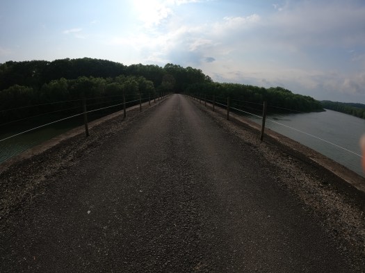
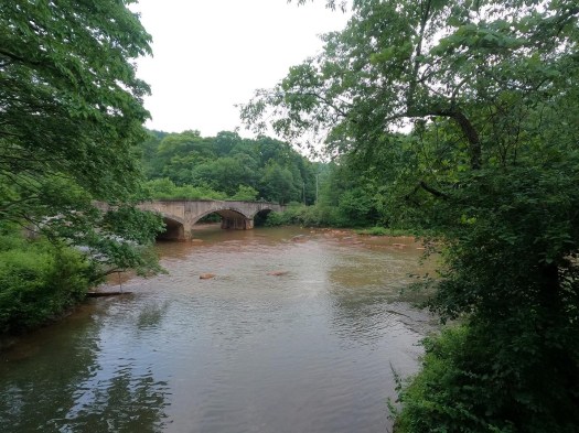
At the Conemaugh Dam, we descended past Conemaugh Recreation Area, crossed the river, and began climbing up Bow Ridge. The Ridge is a narrow sliver in the middle of a big, tight horseshoe bend in the Conemaugh River. The climb is on a gravel road for the first half, then switchbacks and turns into doubletrack trail before quickly descending again. The descent on the eastern side of the ridge is very steep — to the point that it becomes unrideable and then turns into a series of wooden steps.
The Conemaugh Dam was built in 1952 as a flood control facility, and as a result, sometimes the bridges that carry the West Penn Trail over the river are completely underwater in an effort to prevent swelling the Conemaugh downstream of the dam and inundating the nearby communities. This has caused the four historic stone bridges to be littered with debris from the floods, and it also means you aren’t sure if the trail will be passable until you climb up over Bow Ridge if you’re coming from the western end. It had been pretty dry leading up to this ride, so I was feeling confident that we’d be able to get through. Sure enough, as we carried our bikes down the stairs, I saw the dry causeway stretching across the water — we were good to go. Luckily, the first bridge is the closest to the water and thus a good indicator.

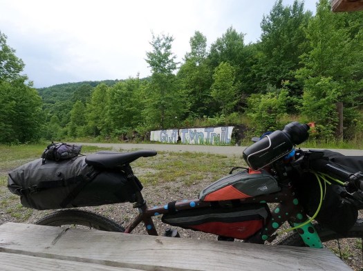
John and I went our separate ways at the Blairsville end of the West Penn Trail. He was going to make a loop with some roads and head back west towards Trafford, and I had about 20 miles to go before reaching my destination goal for the evening — Dilltown. My coworker had hooked me up with friends of his who had a farm just a mile or so off the Ghost Town Trail, and they welcomed me to camp on their property for the evening.
I stopped to have another snack before continuing on the ~7 miles of roads to get over to Black Lick and the western end of the Ghost Town. I was hungrier than I expected and was blowing through my food more quickly than I thought I would. I should have grabbed a few extra sandwiches from the conference lunch. There weren’t many resupply options along this section of the route. There had been some places in Saltsburg to grab food, or a detour into Blairsville would be an option, but otherwise, things are pretty sparse.
I’ll be okay. I know I can refuel in Ebensburg tomorrow, I thought. I still had plenty of food to get me through the evening.
The road section between the West Penn and Ghost Town was really pleasant. The sun was beginning to shine through the clouds, the early evening rays kissing the pavement and adjacent farm fields. There was no traffic, the hours of hustle and bustle past. The aptly-named High Rise Drive took me to the top of a hill the was followed with a gorgeous, wooded descent down Falling Run Road, then views of the dropping sun over Blacklick Creek.
I was relaxed, knowing I’d make it to my destination by dark, and even if I didn’t, it was all smooth sailing now. No more navigation for the day, just 15 miles on the Ghost Town Trail. Little did I realize, those 15 miles would be the hardest part of my day.
The crushed stone surface was wet from the day’s rain, which made it feel like I was riding on velcro. The Ghost Town gradually heads uphill as it makes its way towards Ebensburg, and while it’s less than a 1% grade much of the way, it’s noticeable. Especially when in my head, I thought those would be easy miles.
My back was also starting to hurt. The bike had been more comfortable than I’d expected for more of the ride (see my previous post on choosing to ride my commuter), but at 6-7 hours in, I was beginning to feel the more hunched-over position than I am used to on most of my rides of this length. I alternated sitting and standing, trying to stretch out as I rode, and made every effort to resist looking at my watch every 2 minutes to check the mileage. It was a gorgeous section of trail, paralleling Blacklick Creek in a wooded valley, but mentally, I was struggling to focus on that and not my body parts that were starting to ache or the fact that I was hungry yet again.

I noshed on another granola bar while pedaling, trying to keep moving forward, though slower than I expected or would have liked. After passing the Heshbon trailhead, it seemed like the trail leveled out a bit and wasn’t quite so noticeably a barely-perceptible uphill slog. Upon looking at the elevation profile, I confirmed that wasn’t in my head, and the grade did indeed flatten out a little. The miles began to go by faster again, and soon I was in Dilltown, making a right turn up the hill to my evening accommodations.
I was fed a surprise dinner of rice, venison, and cabbage, which hit the spot, and I set up my sleeping bag and mat under a pavilion just as it was getting dark. My mental struggles on the Ghost Town were long-forgotten, and I basked in the happiness of completing an excellent first day. I was finally doing this ride, and finally bike camping again after way too long.