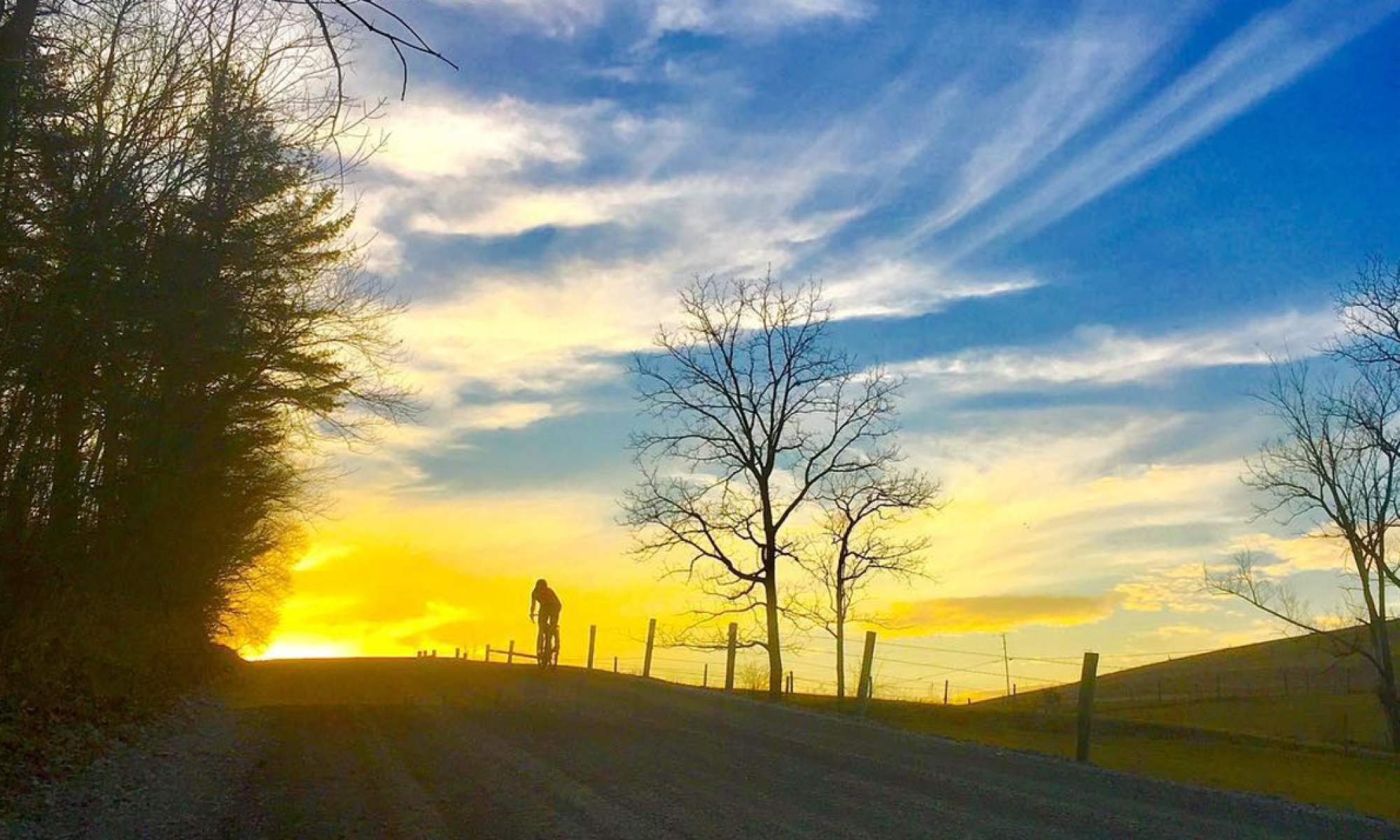

There is a sense of urgency that comes with having good snow for skiing and fat biking that I don’t feel at any other time of the year. I love a gorgeous 65-degree, sunny, low-humidity day as much as the next person, but the fleeting nature of snow is different. It isn’t guaranteed to last, both in the short term (will it melt next week?) or the long term (will winters continually get less and less snowy?). Every day that conditions are good, I do everything I can to take advantage of it.

I’d been casually eyeing up a relatively new snowmobile route from Prince Gallitzin State Park to Black Moshannon State Park that is mostly on state game lands. The route is two or three years old and we rode part of it on gravel bikes a couple winters ago (there was a little bit of snow and ice, but not much, not enough to need fat bikes). In the back of my mind, I knew I wanted to try to do that ride this winter — maybe sometime in February. I thought it might be a good idea to scope out some of the unfamiliar pieces on the Prince Gallitzin end before attempting the full 42-mile route. But then last week, I saw the forecast for this upcoming week — temps warming into the 40s and rain. It would be disaster for these pristine snow conditions we have, and another big snow this winter was likely, but not guaranteed. Maybe I should just do the ride this weekend, I thought early last week.
I casually mentioned the idea to Evan and he was on board for running the shuttle (he’s currently without a fat bike and more interested in skiing right now anyway). He had a big personal push of his own in the back of his mind — skiing a marathon. His thought process was similar to mine. He’d wanted to wait until later in the season, but the forecast stoked that urgency. We both decided to seize the day and the excellent snow conditions and go for our own challenges that upcoming weekend. On Saturday, I’d drop him off at Black Moshannon and he’d ski back to our house in Philipsburg (for the record, he did it — 26.2 miles on the dot) and on Sunday, he’d drop me off at Prince Gallitzin and I’d ride to Black Moshannon. It took very little arm-twisting to convince Shannon to join me.
I was a little nervous leading up to the ride. I was pretty sure it would be the longest ride I’ve done on a fat bike in the snow. A lot of it was in unfamiliar territory. I didn’t know how easy the snowmobile trail would be to follow, if there would be a lot of conflicting tracks branching off and I’d constantly have to try to navigate. I didn’t know if there would be enough sleds on the entire stretch to pack it down sufficiently or if it would be a slow and strenuous crawl through oatmeal. The forecast said it would be in the single digits at the start and it wasn’t supposed to get all that much warmer (teens, but a “real feel” staying in the single digits). I’ve done plenty of cold rides, but not this long, and I’ve done plenty of long rides, but not when it’s this cold. The route crossed 4 paved roads, but otherwise was deep in the middle of nowhere.
But one of my goals for this year is to do more things that get me outside my comfort zone. I’ve been doing plenty of difficult rides but not that many that I’m not sure I can complete, or with a bunch of unknowns. I had a whole bunch of excuses about why it wasn’t the “right time,” but to hell with those.

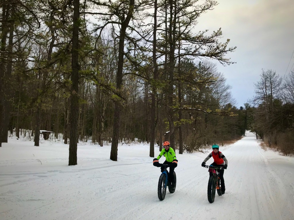
It was zero degrees when I started the car to warm it up before driving to Prince Gallitzin. My fat bike was packed with plenty of food, a liter of water, a spare battery for my phone, front and rear lights, a seat bag with extra warm gloves and a puffy coat, and bike repair supplies of course. I had the route downloaded. Shannon arrived and transferred his stuff to my car and we were off.
The ride started out across the dam at Prince Gallitzin, the sun making the brilliant white snow glisten and taking the edge off the chilly air. In the distance across the lake, ice fisherman’s huts dotted the landscape. On the other side of the dam, we followed Old Glendale Road Trail as it rolled through pines and the sun shone through their boughs. So far, this was dreamy.

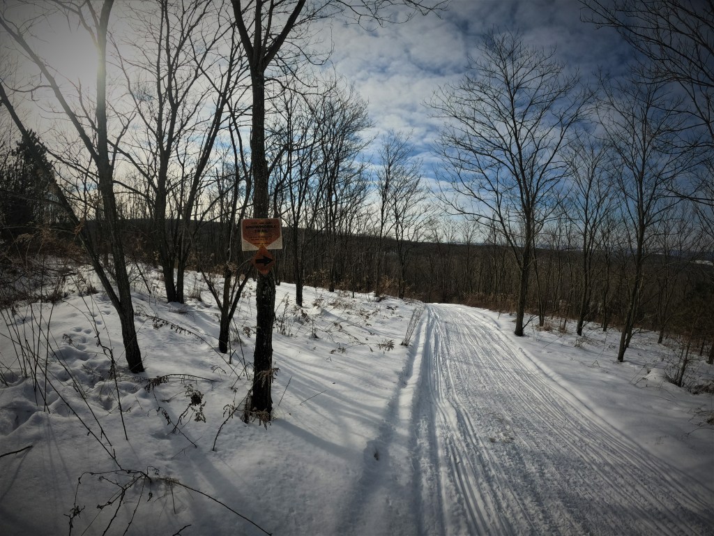
After a couple miles, we exited the park into the small village of Van Ormer. I had no idea what to expect here. Supposedly the snowmobile trail rolled through town, crossed Rt. 53, and then entered game lands. The route followed a plowed-but-still-snow-covered township road and I kept my eyes on the sled tracks, looking for where I knew they’d deviate from the road through a narrow strip of trees between Clearfield Creek and some fields. Sure enough, the route was well-defined and we followed it through the last bit of civilization we’d see for a while.
Once across Rt. 53, we immediately began to climb, steeply in spots. I heated up quickly. My shell had already come off only a couple miles into the ride. I removed my heavy gloves to keep them from getting soaked with sweat and opened up my vest. My hat came off soon after. One of the keys to cold-weather riding is to not sweat too much. If your clothing gets soaked, it only means you’re going to freeze later. I always make sure to have places to put layers if I need to disrobe and regulate my temperature constantly by zipping and unzipping my jacket or vest. Gloves usually come off completely for long climbs, even when it’s pretty cold out.
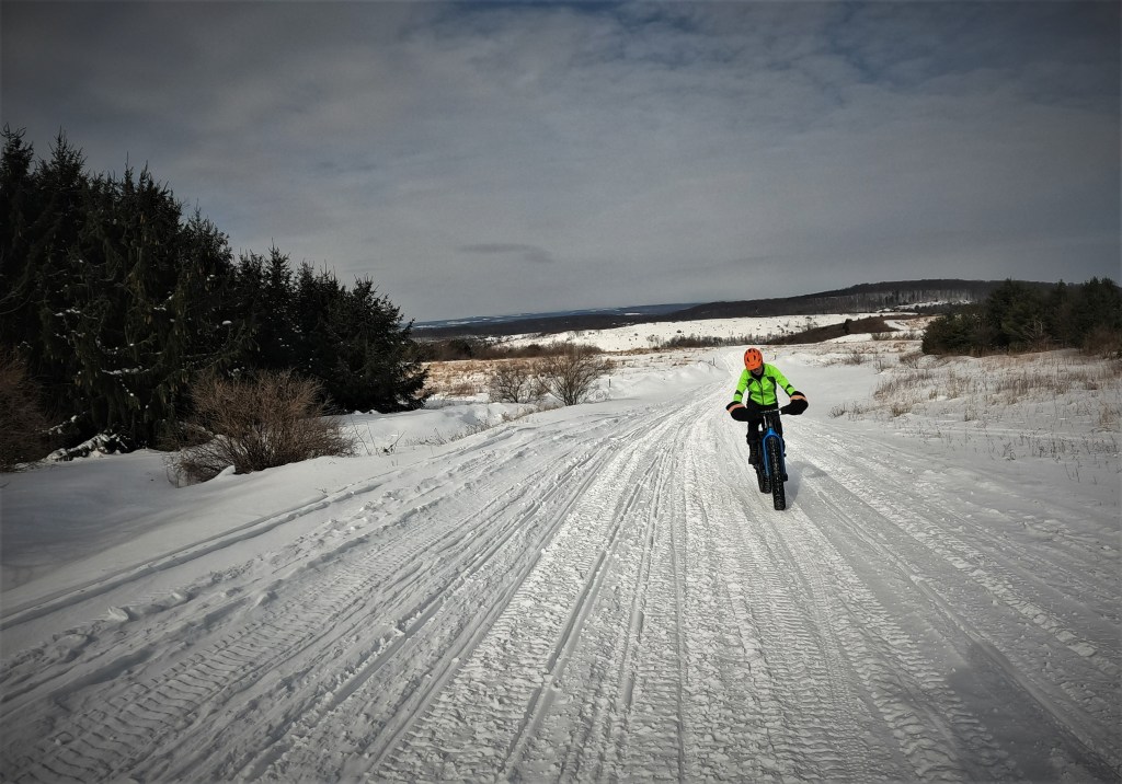
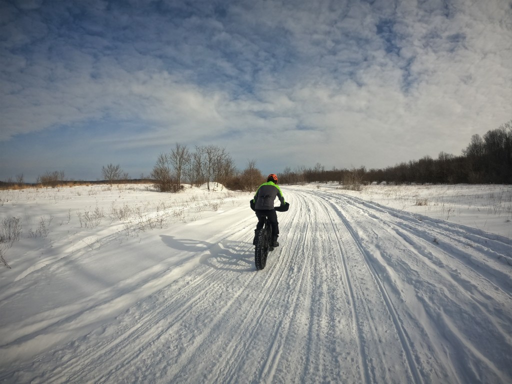
We mostly climbed for 10 miles, but there were some breaks, some flat stretches and short downhills in between. The landscape began to change from densely forested to the distinctly barren abandoned mine lands hosting only grasses and some short, stubbly trees. The wind whipped at us up here, higher on the plateau with little cover. I put my hat back on. The trail was like a highway, wide and fast. My worries about navigation were totally unfounded — the route was marked well, with arrows at every turn and “State Game Lands Snowmobile Trail” signs at frequent intervals. And even if it wasn’t signed at all, there was only one way to go. Sleds weren’t allowed on any of the other game lands roads or trails, so all we had to do was follow the tracks.
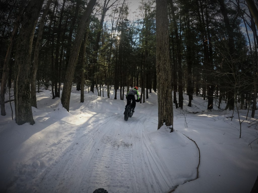
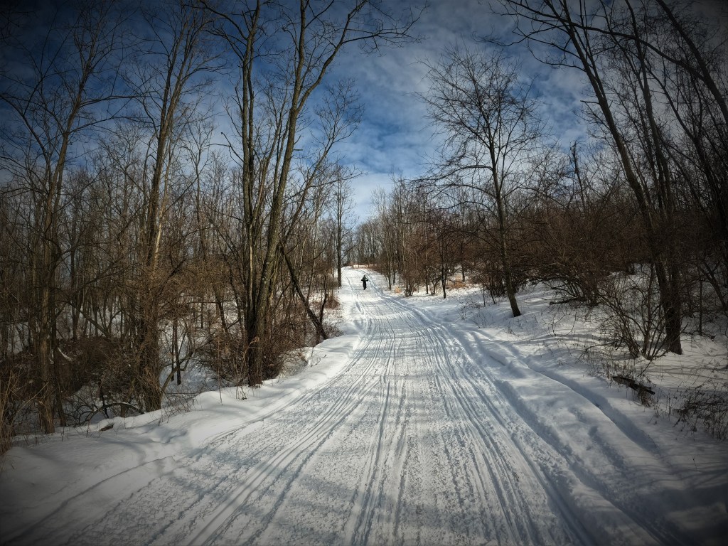
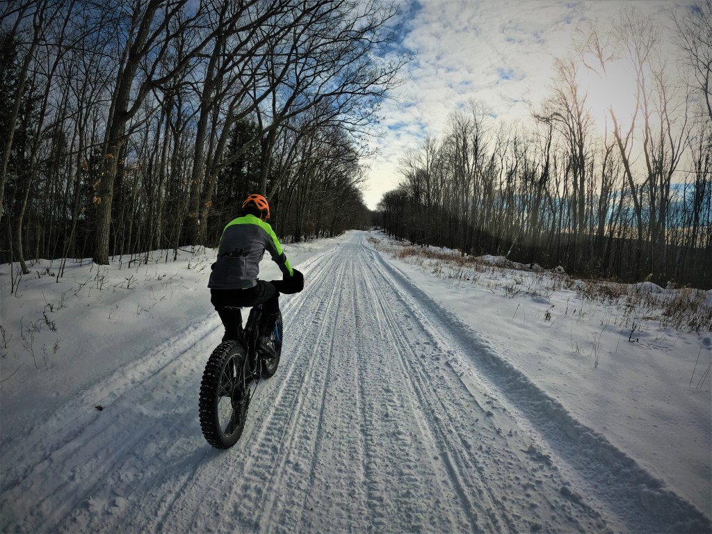
A lot of the route followed gravel or dirt roads and these sections were 20 or 30 feet wide. But there were a few connector sections where there normally isn’t a road in the summer months that were much narrower — just one sled width across. These sections provided a more intimate experience of weaving through the trees. While we were essentially riding the same surface (packed snow) the whole way, there was a lot of variety over the course of those 42 miles.

After peaking at just under 2,600 feet at Lost Mountain, we descended to Rt. 453. Parts of this descent started to look familiar and I vaguely remembered climbing it in the other direction on our “gravel” ride — it was mostly a hike-a-bike through crusty ice, if I remembered correctly. By the bottom my hands were freezing and I regretted not taking off my merino wool liner gloves earlier on the big climb. They were slightly damp, transferring that chill directly into my fingertips. The sun from earlier was long gone and it had begun to snow on and off — not much, just flurries, but the air was noticeably more humid and thus felt colder. I debated grabbing my extra warm gloves from my seat bag, but right in front of us I could see the next mountain we’d be climbing, so I tried to ignore the pain and trusted that my extremities would soon enough be warm again.
The trail paralleled Rt. 453 for a while before beginning a steep ascent up a powerline towards a gravel road at the top, along the way crossing over some running water and mud that I thought was frozen. It wasn’t. I tried to ride across and my tires sank in and stopped. I unclipped and put my foot down on what looked like a solid piece of frozen mud, but my foot sank in as well. Luckily, my 45NRTH Wolvhammers are waterproof and I got my foot out of there as quickly as I could. No harm done.
Shannon had made it through more easily and was already in the distance, casually spinning up the steep grade. I took the opportunity while I was already stopped to pee and drink some water, then resumed pushing my bike. I didn’t have low enough gears or my legs were too tired to pedal up the steepest part. We regrouped at the top, now on the gravel road that had been plowed but still retained a thin layer of snow. The riding was fast for a couple miles. The windmills marked the halfway point, but the second half was supposed to be easier, with less climbing anyway.
Shortly thereafter, the route diverted from the main gravel road onto a side path, which ended the plowed section. The snow was a little softer here, a little squirrely in spots, but still easily rideable. The terrain rolled along the Allegheny Front, with no sustained climbs or descents. It was perfect for keeping us warm. It was still snowing on and off, the sky a prime example of “Pennsylvania gray.” The grays and whites of the landscape blended together and I felt like staring at the snow for hours was putting me in a trance. While in a way it all looked the same, there was also so much texture — the different patterns made by the sled tracks, drifted snow with edges that looked like sculptures, all mixed with highly-contrasting deep orange-brown and yellow grasses.
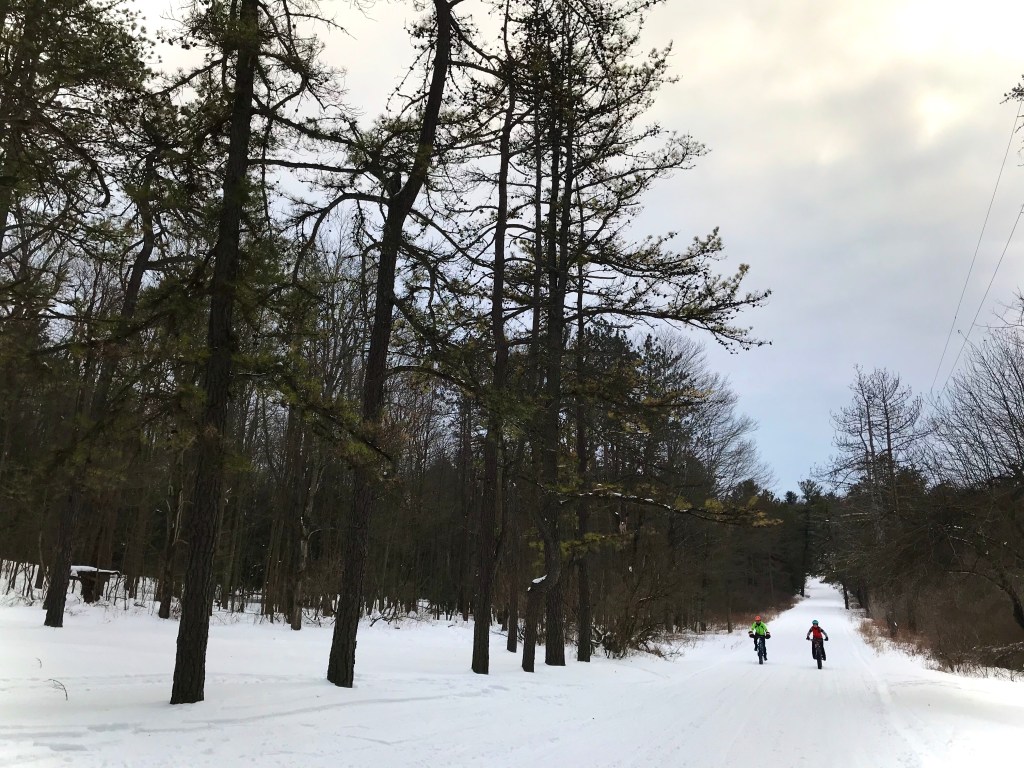
A few cabins along the road and the transition back to plowed signaled that we were approaching Rt. 350. We crossed over and began a gradual climb up Sandy Ridge. This was one of the one-lane sections and it was pretty soft and mealy, much more so than most of the route thus far. I had to get off and walk a few times, and even when I did manage to stay on my bike, it was tough going. I hadn’t studied this section of the route thoroughly and I expected to meet up with Ponderosa Road long before we did, so towards the top I started questioning if we were still on the correct course. But there wasn’t really anywhere else we could have gone, and a few moments after I thought about stopping to check, I saw some game lands signage and the familiar entrance to Sandy Ridge Trail through the trees.
Sandy Ridge was a mental push. We were so close, but still had a couple hours of pedaling left. By 5 hours in, my back and right hamstring were starting to get tight and sore. I alternated between sitting and standing to pedal as much as the conditions would allow, and that helped. I was hungry again. I felt like I’d just eaten, but that was all the way back at the windmill road — maybe an hour ago? I finished off the other half of my toaster pastry and felt better. 9 more miles.

While stopped for a snack, we were passed by a couple of sleds that stopped to chat. The guy in the front lifted the clear piece on the front of his helmet. “Wow! That’s awesome!” he said to us of our fat bikes. “Thanks for packing it down for us,” I told him. “You’re welcome,” he replied with a hearty laugh. All of the snowmobilers we encountered on our ride were courteous and respectful, slowing down and giving us a wave. We always try to return the favor, pulling all the way off the trail and stopping to give the sleds plenty of berth. It is because of them that we can enjoy this unique type of riding in the winter — both because the sleds physically pack down the trails and because of the behind-the-scenes work that snowmobilers do for access. The Glendale Lake Snowmobile Club worked to get the route we were following established, and maintains and grooms it throughout the season. We may be enjoying winter in different ways but we’re all out here in the same place — there’s no reason not to respect each other.
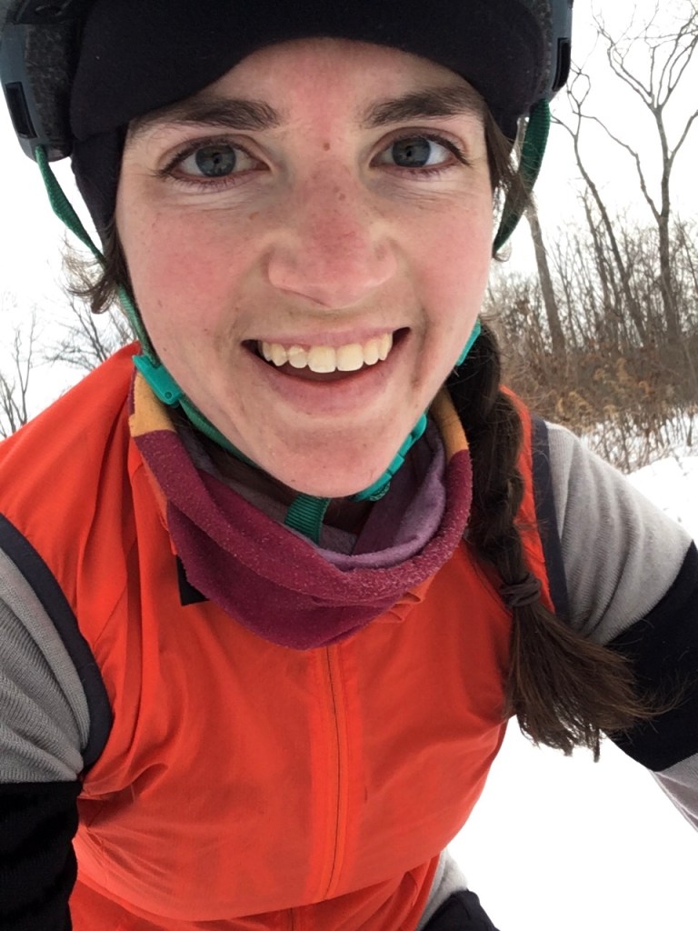
At Rt. 322, I texted Evan to let him know our ETA so that he could come pick us up. The last 7 miles went quickly. I felt like I was totally zoned out from staring at the snow for so long and I had to force myself to stay alert and listen for snowmobiles, but it was a tired euphoria. I was really happy we’d done this ride when we did. It was a great day and I’d definitely do it again. The conditions were even better than I expected and we made good time — 6.5 hours total for 42 miles and just under 4,000 feet of elevation gain. I didn’t have to make use of any of my extra clothes or Evan’s services as sag support, and only had to check the GPX track once for navigation. I drank most of my water before it froze and probably didn’t eat as many snacks as I should have. A couple miles from the end I snapped an exuberant selfie to commemorate my joy. A long day on the bike is one of my favorite things, made even more special by the ever-fleeting nature of perfect snow conditions.

Great story. Thanks for sharing.
LikeLike
” I was hungry again” I believe will be the title of your memoir. Awesome job, by the way!
LikeLike
Ha! Good one!
LikeLike
Awesome!!!! Thanks for this…always looking for new routes!
Assuming the route is in your Strava profile?
Thanks!!!
LikeLike
Yes it is! It could also be ridden in the warmer months on a gravel bike, possibly with a couple modifications. I’m sure of the shape of some of the little connector trails in the summer, if they get overgrown or not, but you can always go around on short stretches of pavement to link the gravel sections.
LikeLike
So jealous of those miles of packed snow in your area!
LikeLike
Helena,
Awesome.
Love your writing !!
Brian
*Brian S. Auman / Landscape Architecture* *www.BSAlandplan.com * brianauman11@gmail.com 570 847-9519
LikeLike
Nice jaunt, Helena; Such a cool(err, cold) ADventure! I had been wondering if the section between Rt 53 and Prince Gallitzen was navigable, signage wise. It is good to hear you managed to follow the course fairly easy through there.
A few years ago on an unseasonably warm day in early March, my brother Mike and I mountain biked from Bells Gap to 53 and back on those snowmobile trails. At Rt 53, we briefly looked for the connection to PGSP but couldn’t find it. We didn’t have time to really investigate further before having to turn around. Over the last few years I have covered most of the route except for a small section on Sandy Ridge, before Ponderosa. Hopefully soon I will follow your lead and do the whole section between PGSP and BMSP.
Thanks for a fun read. Congratulations on your successful journey. Kudos to Evan as well on his marathon ski.
LikeLiked by 1 person
Thanks, Mary! It’s such a neat area and so cool that connection exists.
LikeLike