
The wind blew so hard that I was scared if I let go of the railing I might actually be swept off the small metal platform I was standing on. I’m not one for heights, and as I’d climbed towards the top of this fire tower, I felt my stomach turn a few times. Don’t look down, I told myself, attempting to suppress my natural fear response. You’re not going to fly off and this tower has been here for years and years — it’s not going anywhere. The company of Rob made me feel a little more comfortable, but we both decided to not ascend the last short flight of stairs to the very top of the tower. The view was incredible.

We’d spent the better part of an hour or more climbing to this spot via grassy doubletrack and a loose gravel road that pitched upward so steeply in spots that it took everything I had to keep the pedals turning. I stood, my upper body twisting with each heavy pedal stroke, shifting my weight to keep the delicate balance of traction on my rear wheel while not letting the front end of the bike lift up. Evan ahead of me was the rabbit, the goal that kept me moving forward. Up top, views of the valley to the southeast rewarded the effort. The edges of the clouds in the distance glowed with sunshine, but where we were, the gray hung heavy. It’s full on Pennsylvania gray season now.

The descent from the fire tower on Rattling Run Trail was chunky, and my the end my hands were sore from clutching the brakes that I keep forgetting to adjust so that they are more comfortable for my smallish hands, especially while wearing winter gloves. Towards the bottom, a plaque marking a spot where lovers of “God’s great out of doors” meet annually peaked our curiosity. Did folks still actually meet at this point on that day?

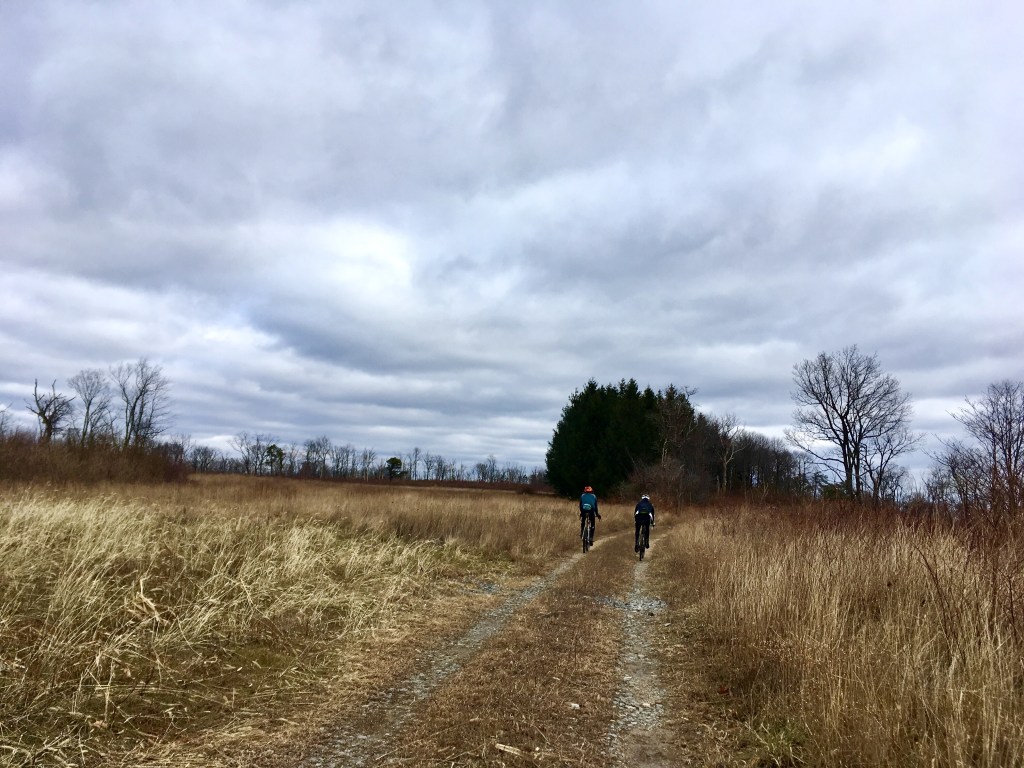
The chunk terminated at the Stony Creek Rail Trail (also known as the Stony Valley Rail Trail or Railroad Grade on the interwebs) and soon we caught up to Nate’s partner Jami, who was riding the rail trail while we did our ride. We stopped and chatted briefly and shared a snack before we took off again, the boys pulling away from me fairly quickly on the flat section. I reminded myself that we were only 13 miles into a 65ish mile ride and there was no need to hammer right now and blow myself up. Going fast on the flats is one of my weaknesses in riding.
I caught back up as they were all stopped and Nate was giving a history lesson about the abandoned town of Cold Springs, which in the mid-1800’s was a resort town featuring two hotels and a spring rumored to have healing properties. The hotels both burned down in 1900, and this combined with the decrease in popularity of the railroad resulted in the end of the heyday of the community.

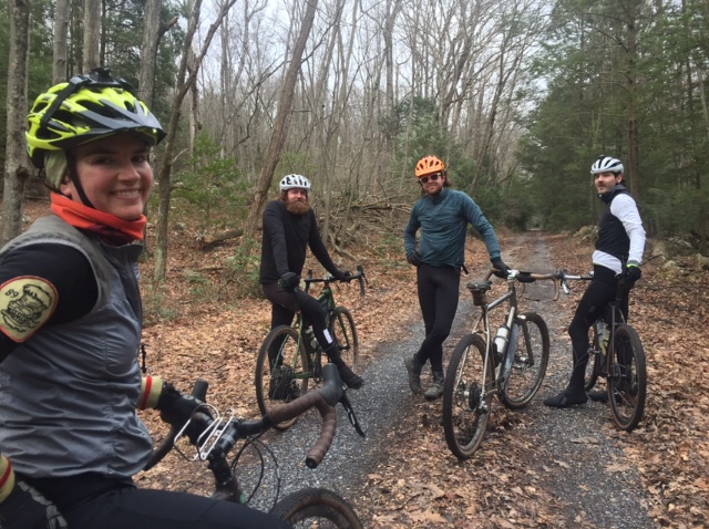
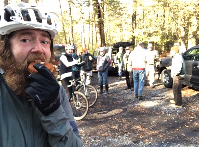
At Rausch Gap, the Appalachian Trail crosses the rail grade, and we stopped to ponder the reason for a group of folks shoveling limestone into two “diversion wells” alongside the stream. The were volunteers from the local Doc Fritchey Trout Unlimited chapter, and the limestone was to neutralize the effects of acid mine drainage, allowing wild trout populations to reside downstream of these wells. One by one, the volunteers stopped shoveling and came up to the trail, eager to tell us about the project. It turns out they meet here once a week to shovel limestone. Then they offered us donuts. We have extras!
I won’t turn down a donut, said Rob, and we all meandered over to the tailgate of a pickup and grabbed the balls of sugary goodness. After a quick group photo at the group’s insistence, we continued on our way towards the first paved section of the ride.
Goldmine Road was a short but steep enough to be a considerable lung and leg burner, but the twisty descent on the other side was a ton of fun. We were then in Swatara State Park, where we followed the Swatara Rail Trail and Bear Hole Trail to another big history lesson of the day.
Along Bear Hole Trail in Swatara State Park stands a beautiful hand-built log cabin nestled against a creek. The main room features a giant window that looks out onto a waterfall. The place is magical. It was built in 1937 by high school teacher Armar Bordner and some of his students using materials found in the nearby woods. When Swatara State Park was formed in 1987 and the state tried to take the cabin under eminent domain, Bordner resisted, and he ended up being allowed to stay there until his death in 1994. As soon as I walked into the cabin, it reminded me of Frank Lloyd Wright’s Fallingwater, albeit a very rustic one.


By the time we’d finished oohing and ahhing at the cabin, we had exactly 2 more hours of daylight and 30 or so miles left in our planned route. And nobody had lights. So we decided to cut off a couple of the detours (to a convenience store and a hawk watch) to give ourselves a better shot of finishing before it got too dark. We boogied the rest of the undulating Bear Hole Trail and up to Route 445, pace-lining on the pavement to Fort Indiantown Gap.

We pedaled towards Second Mountain through the National Guard training center and past signs warning of blast zones and restricted areas. But Fort Indiantown Gap also allows hunting, fishing and other outdoor recreation on its grounds, and is home to a hawk watch and a very rare butterfly called the regal frittilary.
The last climb of the day, up and over Second Mountain for the second time, was just about as mean as the others, but my endurance strength was kicking in and I was feeling pretty good. We skipped the planned detour to the hawk watch at the top in an attempt to get back to the vehicles before dark, instead descending straight down back to Cold Springs. Just before we met up with the Stony Creek Rail Trail again, Nate pointed out the remains of the two hotels that burned down, just stone foundations in the middle of the woods.

Back on the rail trail again, it was a 13-mile, slightly-downhill rip back to where we’d parked. Evan and Rob took off, egging each other on. I rode mostly alone, occasionally leapfrogging with Nate. My right eye was starting to blur, my contact dry from the cold wind in my face all day. This along with the fading light made vision a little more challenging. I squeezed my eye shut in an attempt to moisten the lens.
Just as it was truly getting dark, we hit the paved road and less than a mile later, we were back at the cars where Jami was waiting. Bikes loaded and hugs exchanged, we started the hour and a half drive home. After a holiday season that felt a little suffocating, it was a much-needed adventure exploring somewhere new.


What a great ride. I wish I had been there. Are you riding a gravel bike? How big are the tires?
LikeLike
Yup, gravel bike with 43c tires.
LikeLiked by 1 person