
This story was getting long, so I broke it into multiple posts. The first part discusses my impetus for this ride as well as my bike and gear. The second details Day 1 of my ride.
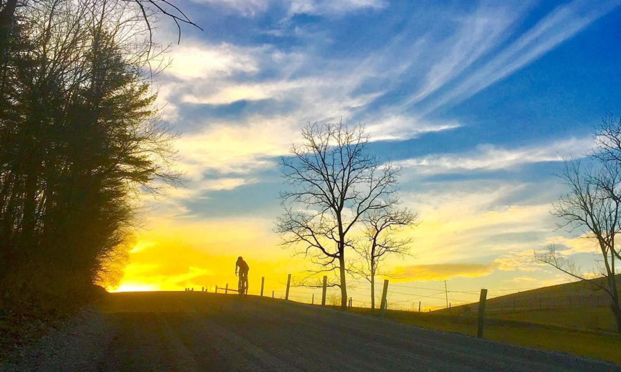
I needed coffee. I had made the decision to go light and forego bringing a stove or coffee setup, and I’d scoped out a coffee shop in Ebensburg to hit 20 miles into my ride. I expected to be up early, on my bike by 6:00-6:30, making it to the coffee shop just as they opened at 8:00 AM. I was looking forward to those early morning miles, the stillness and quiet and solitude.
As it turned out, I slept until almost 7:00, and I was not rearing to go as I’d expected. It took me a while to pack up, my head feeling groggy and out of it. I’d wake up once I started riding. I’m typically a morning person and have no problem getting up early, but after two nights of not getting great sleep in hotels, I may have needed the extra rest. It was a chilly and breezy morning, and getting out of my sleeping bag was also not overly enticing.
But around 7:30, I finally had my bike packed and rolled down the hill back to the Ghost Town Trail. My legs did not feel fresh, and the soggy surface and slight uphill hit me once again. It always takes me a while to warm up though, and I was confident that after an hour or so of pedaling and a coffee in me, I’d perk right up.

Somewhere around Wehrum, I hit the first pack of runners. They took up the entire trail, headed in the same direction I was. On your left, I called repeatedly. After running into more groups, I realized that there must be some event going on. It turns out that it was the day of the Ghost Town Trail Challenge. I didn’t want to impede on the run more than I had to, I didn’t want to have to keep calling out for people to let me by, and quite honestly, I needed a break from the rail trail, so I stopped to check the map and scoped out a couple spots where I could easily bypass the trail on roads. In Vintondale, I took Plank Road to Twin Rocks, and in Nanty Glo, hopped off the trail onto Beulah Road for a few miles.
As I was getting back onto the Ghost Town Trail at Beulah, I spotted a familiar face walking from the small parking area up to the trail. Mike? I asked. He looked surprised to see me, as anyone would in the situation of such a chance encounter. We chatted for a minute and I was on my way, cranking out the last few miles to Ebensburg and my caffeine salvation.

At the coffee shop, I ordered an ice coffee, scone, and turkey and cheese sandwich to go. I crushed the coffee and scone in record time in the parking lot while packing the sandwich for later as other patrons gave me puzzled looks.
Fed and caffeinated, I set out again, up a steep hill that I was not prepared for as I made a hard right turn out of the parking lot. Unable to stay on top of the gear and not wanting to shift under such a heavy load, I stopped to downshift, sheepishly walking for a bit before an easier grade let me start back up again. I navigated my way out of town and into the surrounding country, hills and valleys rising from the plateau, continually climbing or descending. There were a lot of punchy climbs, but it was beautiful terrain and there was hardly any traffic. I was starting to feel a little better after the coffee and sufficient time for my legs to warm up.
I had nowhere to be, except home, at some point today. I’d forgotten how much I love this — just riding my bike, with everything I need, and nothing else to do or think about. I stopped to eat my turkey and cheese at the top of the descent down to Dean, the Wopsy climb looming ahead of me. After crossing Clearfield Creek and Rt. 53, the climb up to the top of the Allegheny Front began.

It wasn’t bad. I expected it to be steeper, but instead it was a consistent, steady grade that was spinnable. At the top, I made a hard left past a gate onto gravel in State Game Lands 108. I’d ridden some of the gravel and dirt roads up here in the past, some in the summer on an exploratory ride from the Bell’s Gap Trail and some during mine and Shannon’s epic fat bike ride from Prince Gallitzin to Black Moshannon a couple winters ago. But I knew I couldn’t necessarily count on winter conditions to be the same as summer. What was groomed snowmobile trail when there was a foot of snow might be totally overgrown now.
When I was plotting my route, I consulted a variety of sources, as I’ve learned to do. Roads on some of the RideWithGPS or Strava basemaps aren’t always roads. And vice versa, sometimes passable corridors don’t show up in the mapping on those platforms. Heatmaps are a valuable source for determining whether or not something is legit, but just because something doesn’t have any heat doesn’t mean it’s not rideable, especially in rural areas where not many people are cycling. So I combine that data with multiple different basemaps, aerial imagery, and in this case, Game Lands maps (there is a new-ish Mapping Center that is much improved upon the old method of consulting the hard-to-read PDFs).
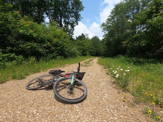
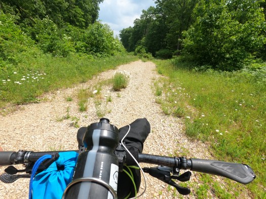
The road narrowed as I got farther in, and part of me got a little concerned that it would peter out. But it showed up as a road in the Game Lands mapping and seemed to get a decent amount of use based on the heatmaps, I assured myself. Wildflowers were blooming on either side and in the middle of the road, and I stopped a couple times to appreciate the landscape and stretch my back that was beginning to ache again.
I began to debate just rolling down the road rather than taking the Bells Gap Trail into Bellwood. A few free miles of downhill was tempting, whereas I remembered the trail being rough in spots and would probably be grassy. The first couple miles from Bellwood headed west are crushed stone, but the rest is grass doubletrack, and the top is rocky in spots. These features are normally what I love about this trail, and it’s especially a really lovely way to climb up the Allegheny Front. But today, I was spent and my back hurt, and heading down the mountain on the Bells Gap Trail would be anything but free miles.
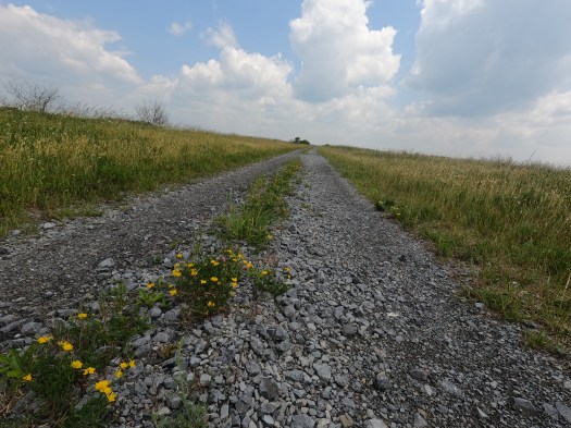
The narrow doubletrack that I was on intersected with a larger gravel road. This one looked vaguely familiar, and I felt assured that my routing was going to get me to where I needed to go. The forest opened up into open meadows with beautiful views of the mountains beyond. It was windy, and it looked like it could storm, but it wasn’t supposed to. The breeze felt great — now early afternoon, it was starting to get really hot.

I’d texted Evan that morning with the link to my Strava Beacon for the day so that he could follow along with where I was, and mentioned that if he wanted to he could try to meet up with me on the Bells Gap Trail. He had other ride plans, so I didn’t expect him to, and I hadn’t heard from him. I thought nothing of bypassing the entrance to the trail and taking the road all the way down to Bellwood.
I coasted through the small town, crossed Rt. 220 and the I-99 interchange, and started my last big climb, up Skelp. I hadn’t been on this road in ages, and never on a bike. It started out unassuming enough, a very gradual grade, but I knew it got pretty steep at some point.
Turns out, it was even steeper than I remembered. Or maybe my legs were just really tired. I struggled to keep the pedals turning on the steepest section, but I was determined not to walk, especially as cars kept passing me. At one point, a car slowed down next to me, almost to a stop. I thought it maybe was someone I knew who wanted to say hi. I turned to look, and saw a guy I didn’t know just staring at me. I gave him a look that said what do you want? He sped up a drove away. Weird.
Finally, I reached the top, no walking needed. I rolled down into the undulating Sinking Valley, now on very familiar roads and terrain. I’d drop down to the Little Juniata River, climb back up, then have just under 10 miles to go.
I was moving slowly but steadily. I was having fun but I was also ready to be done. The ride as a whole had been harder than I expected. For some reason, I thought by splitting it up into two days, and because a lot of it was rail trail and there wasn’t a ton of elevation gain compared to many of the rides I’m used to in central PA (just under 10,000 feet in 157 miles), that it would be “easy.” I got into my head a bit on the second day because I thought that I “should” be feeling less tired.
The reality was, 80-mile days back to back, loaded with overnight gear, was not easy no matter which was you slice it. Especially when I consider that last year at this time I was just a quarter of the way through chemo and uncertain when, if ever, I’d be doing ride like this and feeling relatively good again.
When I arrived home, Evan lightly teased me for skipping Bells Gap. He had gone to meet me, and was waiting for me halfway down the trail. He’d seen my dot making its way across the top of the Front in the Game Lands, but then his phone died so he was unable to see where I was after that, when we realized that I’d gone down the road instead. I felt a little guilty, like I had “cheated” by not completing the route exactly as I’d intended, but it was my own ride. I’d done what I needed to in the moment, and I’d pushed through feeling both physically and mentally tired all day long to finish the ride. It was still an accomplishment.
And despite any struggles, it was still a fantastic ride. I was really happy with the route and I’d definitely do it again. I still would like to try to do it in one day, and I’d like to try it in the other direction. I won’t stop going to Pittsburgh for work anytime soon, so there should be plenty of opportunities to give it a go.


i sent your two blogs to my friends. Congratulation
LikeLike
Holy cow, that’s a heck of a journey! As someone who is happy to be able to ride her bike to the grocery store and back (and sometimes on our local Rails to Trails), I am astonished. Way to go!
Since I’m less familiar with the lingo of which trails run through which counties, is there an easy way for me to tell how much of your journey was in the PA Wilds? Do you have a map of your route? (Maybe I missed it within the fantastic writing!)
Thanks, Helena! Hope to run into you soon.
LikeLike
Good writeup and use of the rail trail infrastructure. Bikepacking/Touring on multi-surfaces is my passion.
As it turns out, I grew up within 2 miles of Westmoreland Heritage Trail in Monroeville and spent my youth (in the 1980s) riding bikes offroad with my buddies along the railroad corridor, long before it became a rails to trails.
This spring, I got curious about all the rail trails in the Pittsburgh region. It seems like we have quite a few trails. How about 700 miles within 70 miles of the point?
Writeup with links to maps:
https://www.google.com/maps/d/edit?mid=10IhpFH_ld-8wqwrkOMK3e_x1eKtvftI&ll=40.375467014829354%2C-80.13763157278508&z=9
JHL99
LikeLike
Posted the link to a Google Map above, here is the writeup:
https://drive.google.com/file/d/1k-nmI0XwtyCqW6a2uDWDt9VCIJYXbR39/view?usp=drive_link
LikeLike