
Cover photo by Ben Carpenter.
Nestled against the North Carolina and Tennessee borders just east of Damascus, Grayson County, Virginia is flanked by Mt. Rogers National Recreation Area and George Washington and Jefferson National Forests, Grayson Highlands State Park, the Virginia Creeper Trail, and the New River Trail State Park. The terrain is rugged, there are are undoubtedly more cows than people, and many more miles of gravel roads than pavement. In early October, I was invited on a 3-day bikepacking trip on a new route called the Grayson Gravel Traverse, which connects the Virginia Creeper Trail on the western end of the county with the New River Trail on the eastern end. A group of nine gathered at the caboose in Damascus on a sunny Sunday morning, bikes loaded with gear for a few days of riding. We hailed from Virginia, North Carolina, Maryland, and Pennsylvania, a motley crew of storytellers ready to find out what Grayson County had to offer.


We began our journey heading uphill on the Virginia Creeper Trail, which follows 34 miles of a former rail right-of-way and is named for the train that was called the same. Most riders on “The Creeper” grab a shuttle from Damascus to Whitetop and ride downhill all the way back. We were passed by hundreds of cyclists rolling in the other direction, some more in control of their bikes than others, some sporting huge smiles, some appearing slightly terrified, some with faces fully covered against the chill in the air.


The rail trail followed Laurel Creek for much of its length, crossing the waterway as well as smaller tributaries numerous times. Views of the water cascading over large boulders against a backdrop of colorful autumn leaves were a continuous sight along The Creeper as it wound its way towards Whitetop Station. A few small businesses along the trail were packed with cyclists enjoying the sunny, crisp Sunday afternoon.
At Whitetop, we made a quick stop at the old train station to look around. The original building, which once was the highest train station east of the Rockies, was torn down after the abandonment of the railroad in 1977, but a new construction serving as a visitor center was erected in its place and is now operated by the Friends of Whitetop Station.


Lunch was a few miles of back roads away, at the Whitetop Mountain Molasses Festival, where I did not find any molasses (I didn’t actually look) but did get to hear some real deal local bluegrass. Packed into the fire hall, we were serenaded with banjos and stand up bass over chicken dinners and $1 slices of cake. It was impossible not to wiggle, and eventually Cynthia went up front to join the group of ladies dancing. I followed to take pictures, but it wasn’t long before I stripped off my jacket and took to the dance floor as well — not something I’m usually brave enough to do, but something about the friendliness of the people and the welcome they gave to this strange group of people in Lycra made me feel instantly comfortable.

Warmed up from hopping up and down to a few songs, we made our way back outside, breathless and grinning. It was about time to keep rolling down the road towards our evening accommodations. The second half of the day followed mostly gravel roads with plenty of punchy climbs and pastoral views. There was no reason to hurry, and with a focus on capturing the experience in photo and video, our group took it slow and paused often. It was nice to not have to worry about anything but riding my bike — no life chores to accomplish, no need to rush off to work, not even any camp to set up or meals to cook. It was a cushy bikepacking trip, and I was fully embracing it.


We rolled into the Grayson Highlands Inn and General Store in the late afternoon and were greeted by the warmth of its new owner, Paula. She showed us to our rooms and where we could store our bikes in the garage, and made all our mouths water as she described what she was making for dinner (enchilada casserole, salad, gumbo, and cinnamon roll bread pudding for dessert). After a change of clothes and showers for some, we gathered around tables in conversation until the food came out. Everything was as delicious as it had sounded, and we filled our bellies until we couldn’t anymore before heading off to bed.

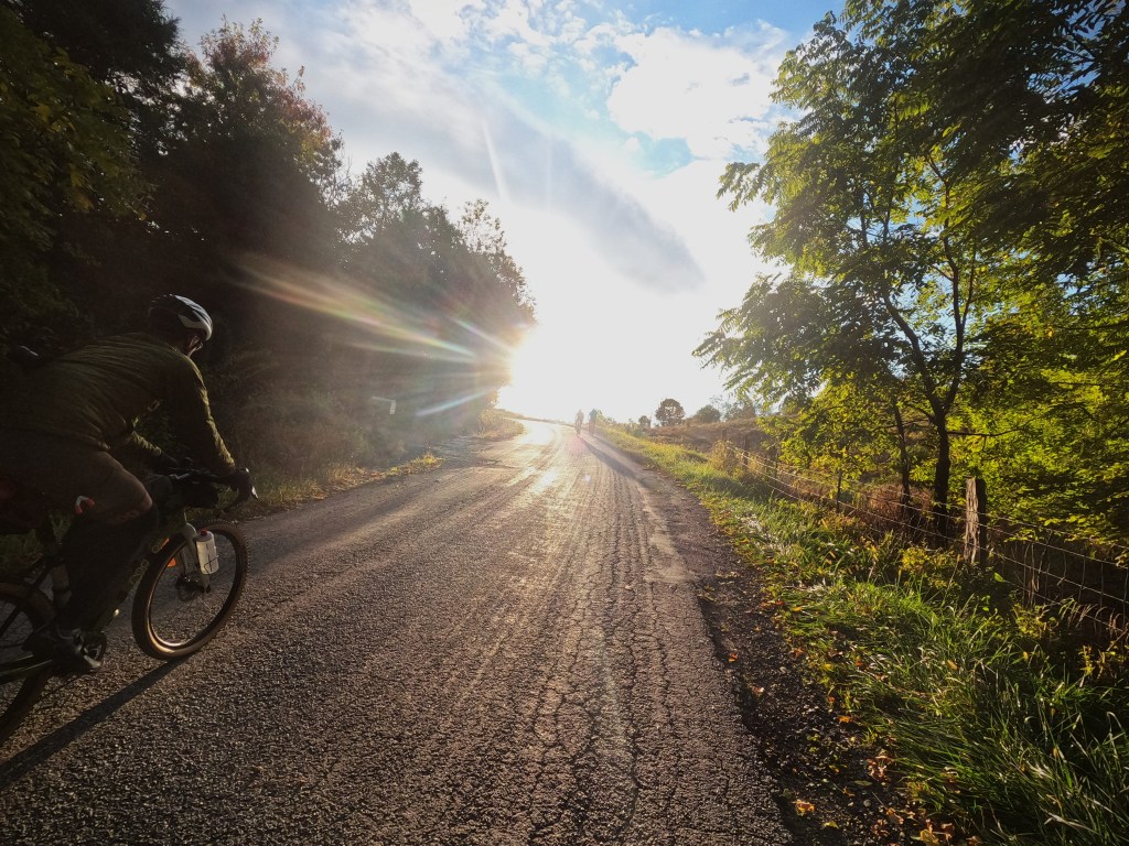
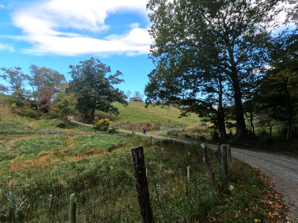
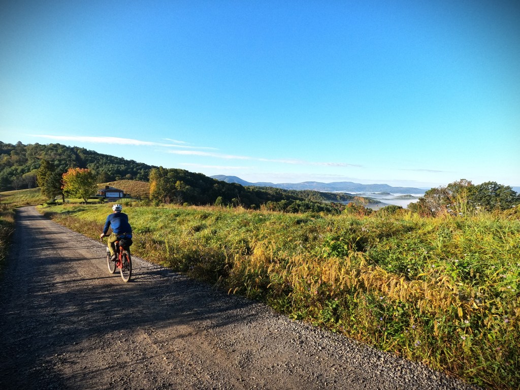
Breakfast was equally satisfying, fueling us for a chilly morning in the low 40s. We hesitated to leave the warmth of Paula’s store, but another day of fantastic riding and storybook scenery beckoned. Several miles of climbing right away was a welcome warmup, especially as we crested the top of the first climb to the sun shining brightly into our faces and bathing the valley in light. The 32-mile first half of the ride featured endless fun, rolling gravel roads through farms and gorgeous views of layers of mountains. There is no flat land in Grayson County, so farms are all on the hillsides. There are a lot of cattle, sheep and goats, as well as Christmas trees and other woody crops, and there aren’t large, flat, square fields like I am used to seeing in the valleys in Pennsylvania.
The landscape instead is dotted with big boulders, idyllic creeks, and old barns and churches. Most of the services are located on Rt. 58 — one of the busier roads in the county — so as the route meanders its way from west to east, it links up with the main road to hit restaurants, convenience stores, and lodging. Otherwise, it follows gravel roads, many of which are narrow and somewhat loose and chunky in spots. There is no cell service in most of the county, except near a couple of the “larger” towns.


Lunch in the county seat of Independence was at an Italian/pizza joint called Ciro’s. We had put in our orders the day before, and many of us ordered medium pizzas, which were supposed to be 12 inches — a seemingly reasonable amount for one person who has been riding bikes all morning to eat. When the pies came out, our eyes almost fell out of our heads. They were huge, easily splitable between at least two people. We laughed and laughed at the ridiculous of the amount of food that was on the table, once again stuffing ourselves until we couldn’t, some of us packing extra slices in foil to go, fastening them to seat bags for the afternoon ride ahead.

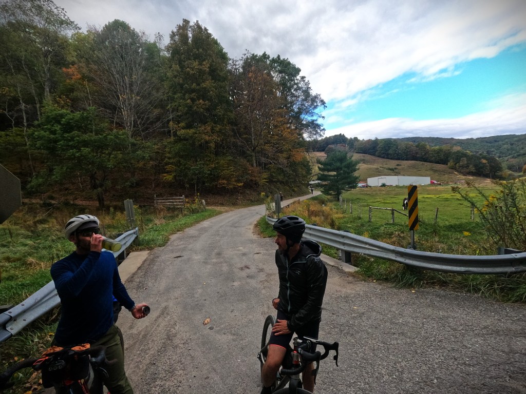
Outside, it had begun to rain. When we’d checked the weather for these few days right before the trip, it looked like it was supposed to be dry, so while I brought a jacket just in case, I hadn’t really planned to ride in wet conditions. Now, it looked like it was supposed to be rainy all afternoon and into the evening — all part of the adventure. The copious amount of cheese and bread in my belly from one too many slices of pizza kept me warm (and my legs heavy) all afternoon.
Highlights of the route between Independence and Fries included a fast-rolling gravel road paralleling a picturesque creek and views of the water tumbling over smooth boulders, unexpectedly passing a tiny general store straight out of a movie, and a giant light-up sign with removeable letters and a big arrow advertising Sunday service.

The final descent into the town of Fries (pronounced “freeze”) dropped us out adjacent to the New River and the historic Washington Inn, where we were met by Grayson County Tourism and Economic Development Director Tracy Cornett. This route was the brainchild of the leaders of Grayson County, a way to get cyclists to travel through the county instead of only to the trailheads at either end. Along with other visionaries, she partnered with David Landis, owner of Village to Village Press and creator of the TransVirgina route, to make it happen.
The official finish of the Grayson Gravel Traverse was down the street at the Fries Trailhead of New River Trail State Park and a caboose matching the one in Damascus, a ceremonial bookend tying the route together. We made our way to the trailhead, where we posed for group photos, shivering in front of the dam before retiring to our respective Airbnb’s to warm up and change out of our wet bike clothes. Crafted by the chefs from the soon-to-open Dam Steakhouse, dinner was served in the dining room of the Inn. Some folks split a bottle of wine and we regaled Tracy and other locals with tales from our ride over a myriad of appetizers and steaks as large as our plates.

Some of our group had to end their journey in Fries, but the rest of us planned to ride all the way back to Damascus the next day, a 77-mile ride which would complete the entire Grayson Gravel Circuit (the “Traverse” is technically just the 72-mile route between the Virginia Creeper Trail at Whitetop and the New River Trail in Fries). The anticipated long drives home (for some of us) following a long ride necessitated a 6 AM rollout in the dark to the New River Store and Deli for breakfast. Handwritten signs outside advertised the specials — 2 for Tuesday (2 cheeseburgers for $2!) and Weenie Wednesday (hot dogs, of course) — while inside, our biscuits and breakfast sandwiches were cooked to order as we sipped gas station coffee and the sky outside began to lighten.

Bellies full yet again (I’m pretty sure I came out of this trip with a calorie surplus), we headed back into Fries and immediately climbed back out of town through the heavy fog that hung like a wet blanket in the air. It was chilly but pretty, especially when the morning sunlight began to poke through. The hollows held the cold for hours, so while each climb promised warmth, each descent plunged us back into a natural freezer. The terrain rolled through these hills and valleys for the first 30 miles to Comers Rock, where we began climbing steadily to the highest point of the day at over 4,000 feet.


The character of much of this last day contrasted with yet complemented the previous two. A lot of the route was within George Washington and Jefferson National Forest, and felt remote in a very different way than the rural farm roads of the southern end of the county. The entire Circuit is a well-rounded loop offering a variety of unique experiences.

The last climb of the day, a paved, gradual 2-3% grade, took us over the pass on the northern side of Mt. Rogers, crossing the Appalachian Trail before descending down to the sleepy little village of Konnarock. A convenience store serving tacos offered fuel for the last leg — one final amazing gravel road, which intersected with the Virginia Creeper Trail for the final 17-mile downhill to Damascus.
Back on the Creeper, I wondered how traffic would be on a weekday, albeit a beautiful one. While not as crowded as Sunday, we still were passing people pretty continuously, this time headed in the same direction. The downhill grade was more than noticeable and it was way too easy (and tempting) to go really fast, but blind corners and ample trail traffic kept our speed in check. Still, those last 13 miles went by quickly, and soon we were rolling back into Damascus and the end of our Grayson County journey.
More information on the Grayson Gravel Traverse, including the route, can be found here.
Stay tuned for my upcoming article in Adventure Cycling Magazine in spring 2024.


Just finished the Grayson Gravel Traverse with a couple of friends – it is a beautiful but very challenging route! The people along the route are very friendly and the scenery is spectacular but it is a trip for the very fit enthusiast and not for casual riders. The hills have some very steep grades (pack light!) and the gravel surface makes both ascending and descending tricky. The descents in particular are quite technical and you need to check your brakes thoroughly pre-ride and maybe put new pads just to be safe. Also, we encountered several dogs along the route, not all of them friendly, so bring some biscuits or another method of deterring their advance. All-in-all, a unique scenic trip for a super fit rider!
LikeLike