
It began to rain before we’d even left the house. It’s not going to last, I said. The forecast called for a high chance later in the day, but only a minimal chance until 3 pm. We were heading north to park at Hyner Run State Park and ride up to Wellsboro, stay in a hotel, then ride back the next day. The rain continued for a while as we drove northward, spattering the windshield as we sipped coffee in the dark. But as the sun rose, the skies cleared, and by the time we got to Hyner Run, it was dry.

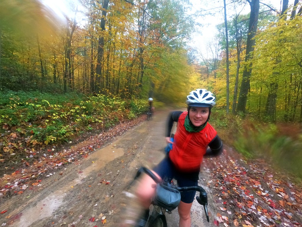
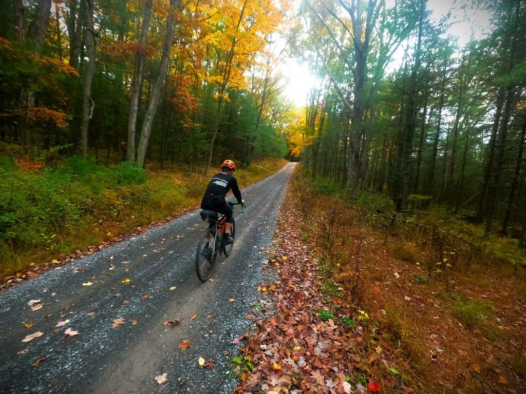
The rain started again just a couple miles into the ride as we were climbing Hyner Run Road. We stopped to don rain gear. The colors of the leaves were so unbelievably vibrant, the gray and rain accentuating the yellows, reds and oranges contrasting with the dark gray of the gravel road. Rain or not, this was going to be a great day and a beautiful ride.
It was mid-October, and we were originally were supposed to go to Big Bear Lake Trail Center in West Virginia and camp and mountain bike for a couple days with a few friends, but the rainy forecast looked even worse there, and camping in 40s and rain wasn’t exciting anyone. So we came up with a new plan and made it happen in a hurry — a “cushy” (on paper ) overnight — riding to Wellsboro to stay in a hotel, then riding back the next day. It would also be Shannon’s first bike overnight.
Anders put a great route together that spanned Sproul, Tioga, and Tiadaghton State Forests, about 145 miles in total. It included some new-to-me territory linking the Cross Fork area and the Pine Creek Gorge area, filling in another gap in my north-central PA map.


We climbed for nearly 8 miles up a mellow grade to Rt. 44. It was welcome warmth, and pockets of fog and the dripping leaves provided plenty of visual candy. A screaming descent down Benson Road (which we had climbed just a few weeks earlier on another fantastic overnight — I will write about that one too when I have some time to catch up) led to the Young Womans Creek valley and another, shorter climb up Robinson. This region exhibits topographic characteristics which Evan has dubbed “The Cauliflower.” Rather than long, linear ridges, the creeks form many smaller hills and valleys and nubs, like the surface of a cauliflower. The climbs are typically pretty mellow, but long.
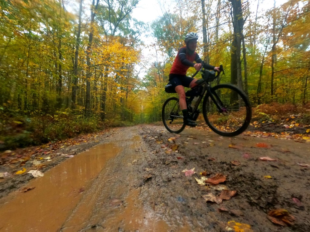
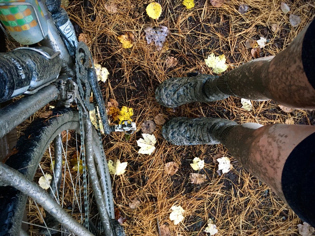
A the top of Robinson we cut off onto some grassy doubletrack to avoid getting back on Rt. 44. Bright white wildflowers popped through the tall grass in an open field. We descended a loose, rocky trail back to another gravel road. Another short descent and climb, and we made a left onto an extra muddy section. The wet dirt had turned into a peanut butter consistency and mud puddles dotted the surface. Gravel can be gritty and tacky when wet, but this was another level of mud, grit, and velcro.
My poor bike, I thought as my drivetrain grinded with each pedal stroke, the grit working itself into every component and orifice. We slogged through undulating rollers, the crests opening up into views of endless cauliflower peaks doused in fog. At some point, it stopped actively raining and the sky brightened ever so slightly. This seemed promising, but I knew better than to think it would last.


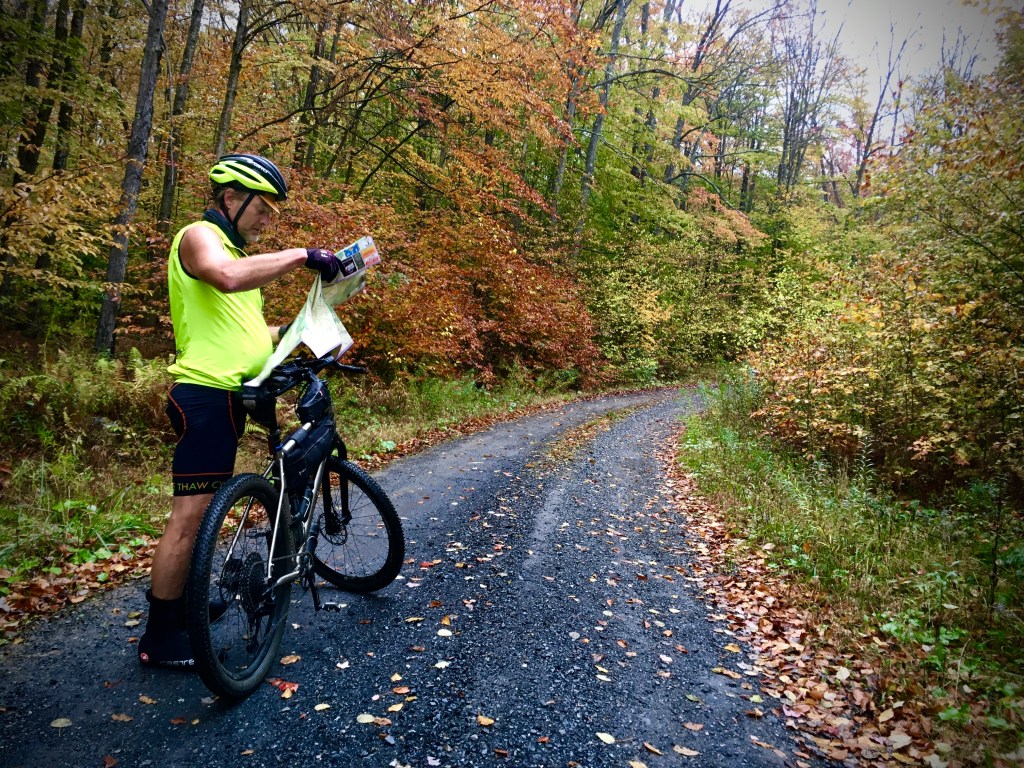
We regrouped at a four-way intersection. Anders was looking at the route. Normally, I am pretty attentive to where we are, partially because I just love looking at maps and having my bearings, and partially because I know that navigation is one of my strong suits and the skill that I bring to the group. But I had a busy day of work leading up to the last-minute ride so I didn’t study the route with my usual diligence ahead of time, and I was too wet to exhibit my usual enthusiasm for map reading. I just wanted to keep moving, and for once I was actually really enjoying just following along and not making any decisions.
It was decided we’d turn right. More rollers, more mud. More vistas. I saw some signs for Shephard Road. That sounds really familiar, I thought. When had I been on a Shephard Road lately?
We beared left at another intersection, but the road dead-ended at a compressor station. That’s when we all realized we had gotten off course, by a lot. I realized that we had been on Shephard Road a few weeks prior on that aforementioned overnight, and we were heading south again, back towards Hyner Run.
There was nothing to do but turn back, back to the four-way, all the way back to Whitman Road, where we’d made a left instead of a right. Ironically, the worst mud of the day wasn’t even part of the planned route.
But nobody complained and nobody got mad. We rode the 7 miles back that we’d gone off course, stopped at Ole Bull Vista to take in the sights, and continued on our merry way. It was still not raining anymore and the terrain, scenery, and peak fall colors more than made up for any discomfort we were feeling.

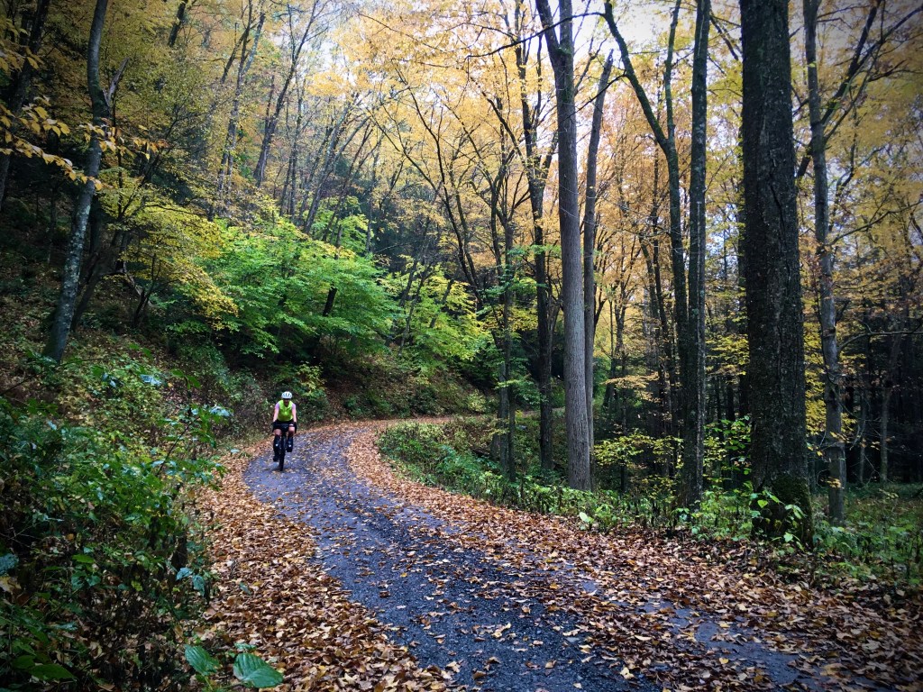
Northeast of Rt. 44, we followed Rauch Road to Randall Road, which reminded me very much of McConnell Road on the northwest border of Hammersly Wild Area — one of my favorite roads that I have ever ridden. It twisted its way along the edge of a ridge, offering continuous views. I got lost in the visuals — the fog, the leaves, the rocks embedded in the dirt road, the mud puddles.

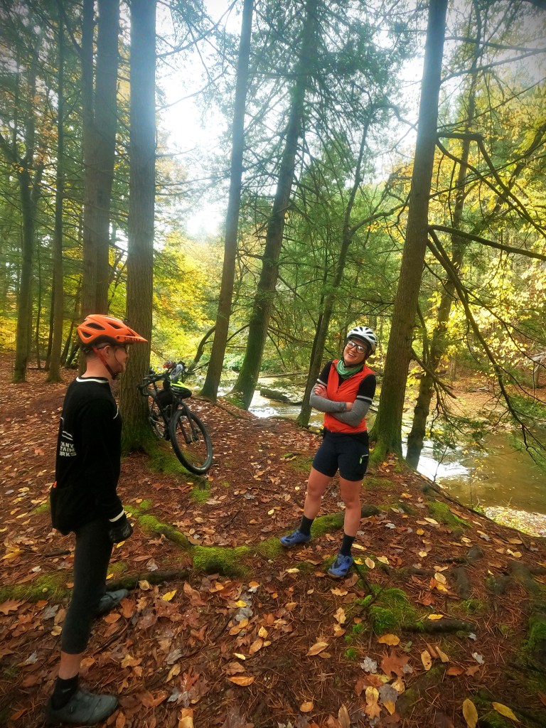
At Butternut Hollow, Anders suggested dropping down the ridge a bit and then climbing back up to hit Cushman Vista, rather than backtracking to it from the top end. We all were game, all of us always happy to climb, especially when it would warm us up.
As we stopped for a snack and to take in the view at Cushman Vista, it began to rain again. It was creeping up on late afternoon now, about the time that the rain was originally forecast to begin. It had gotten a head start, but it wasn’t past. I fully expected to ride in the rain the rest of the way to Wellsboro.
It turned out to not be bad — showers off and on but not a steady deluge. Still, by the time we approached Colton Point, we were all ready to get to the hotel and get dry. After descending from the Point, we followed some paved back roads that parallel the Pine Creek Rail Trail. The pavement felt fantastic after a full day of slogging through velcro gravel, and we stayed on the road as long as we could before we had to jump on the trail for a few miles to stay on course.
We were so dirty that we didn’t want to walk into the hotel in our current state, and rinsing our bikes also sounded like a good idea, so we schemed to find a car wash before rolling over to our accommodations. We spotted one on the edge of town and took advantage of the opportunity, laughing hysterically as we took turns spraying one another down along with our bikes.

Our room at the Canyon Motel turned out to be well-suited — a suite on the second floor, with its own balcony and private access. We could take our bikes upstairs and leave them on the balcony and they would be safe, yet not take up room indoors. We took turns showering and all spread out our soaked clothes in the little common room, which had an electric “fireplace” that cranked out heat. Perfect. Hopefully this would help our clothes dry before tomorrow. We also made use of the hair dryer as a sock and shoe dryer, which required patience but worked reasonably well, at least for socks.
Stoked that The Roost was open again, we headed there for dinner and were joined by James, the organizer of Mammoth Endurance Gravel (if this event isn’t on your radar, it should be). Bellies full of burgers, we wandered the still-wet streets back to the hotel, where we grabbed hot chocolate packets from the lobby to make “nightcaps” in our suite. The warm, sweet liquid was satisfying, and we headed off to bed feeling cozy inside and out.

Morning brought the realization that our wet clothes had barely dried at all and the air outside was chilly. Anders had been up most of the night with a migraine, so he slept in while the rest of us went on a search for good coffee. We walked through downtown but none of the establishments serving coffee opened before 9 AM except Dunkin’ Donuts. I guess that’d have to do. While we were at it, we ordered breakfast sandwiches and donut holes to share, and stopped by the grocery store next door to grab snacks for the day’s ride.
Anders and I had gone back and forth the evening before about various route options back to the car. Originally we’d intended to loop northward for a bit to pick up some of what we had skipped en route to Wellsboro in an effort to get out of the rain more quickly, but with the later start we realized that wasn’t going to happen if we wanted to get back to the cars before dark.
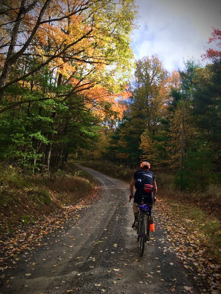
We instead opted for a more direct route that headed directly south out of Wellsboro through some rural residential areas and farmland before descending into the forest on Stoney Fork Road. It turned out to be a beautiful morning, with periods of sun poking out from behind the clouds and the wind quickly dried our still-damp clothes.
While stopped by a small stream to regroup and snack, a feeling of contentment washed over me. I absolutely love traveling by bike. I had everything I needed, I was warm and comfortable, and the company was good. In that moment, nothing else mattered.
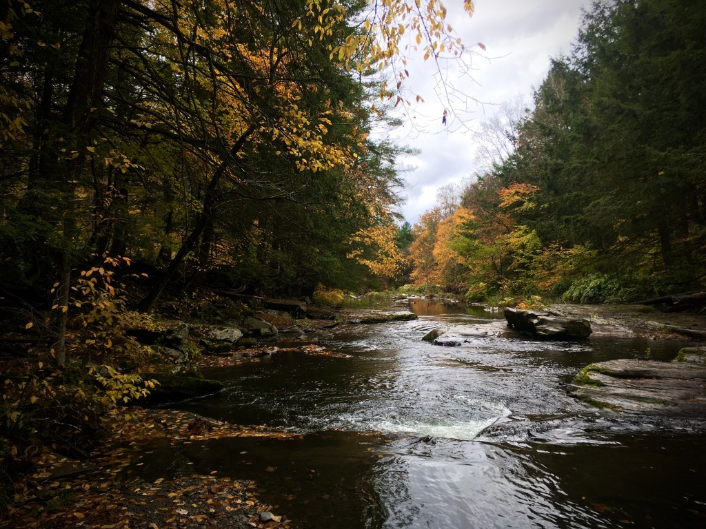
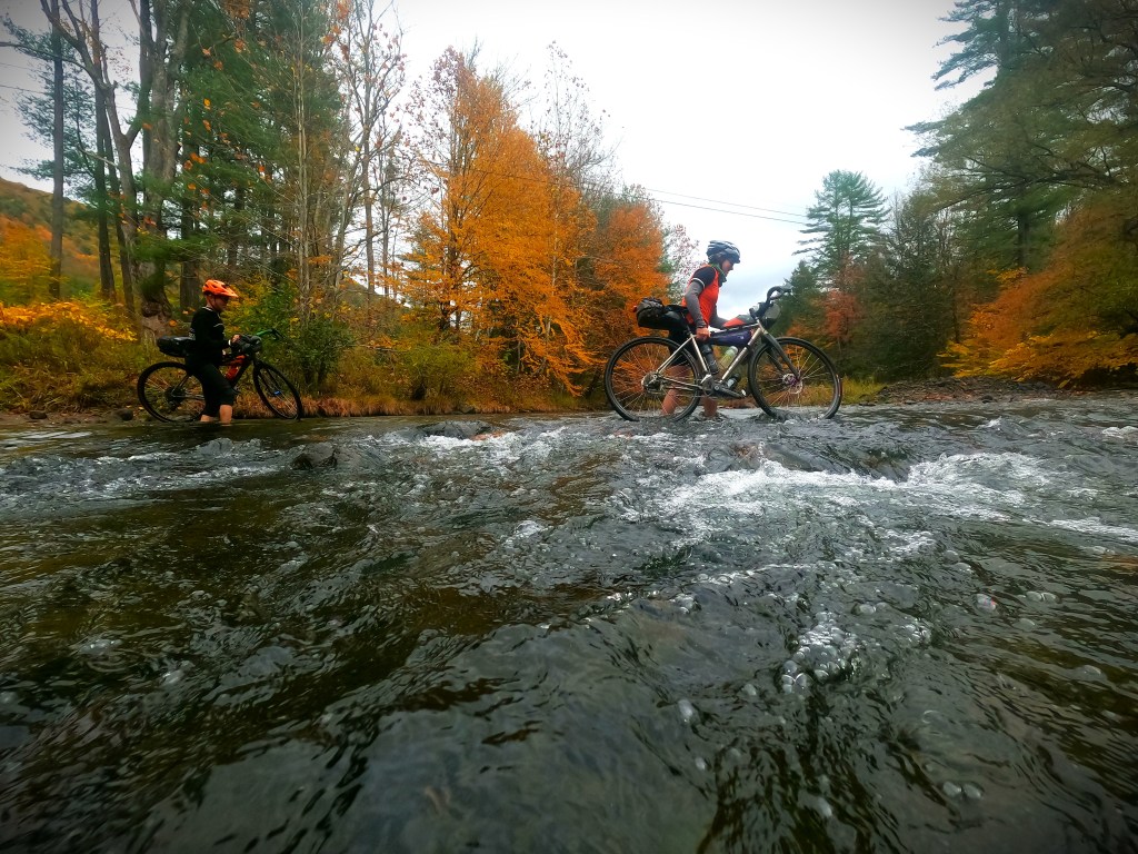
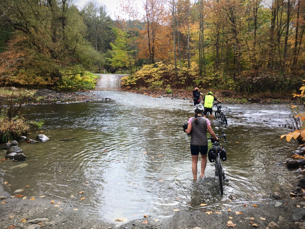
Stoney Fork Road ended at Wilson Creek with no bridge across the waterway. I had an inkling this was coming. I vaguely remembered the Mammoth route changing last minute one year because this creek was too high to cross. At least this time, it looked totally doable.
We all took our shoes off, not wanting wet shoes for the rest of the day, and waded across. The water was almost up to my knees in spots — definitely too deep to ride across, at least for me. The current was swift and I felt like I would have gotten swept downstream. The cold water cascading over my feet was actually pleasant despite the chill in the air, though ten degrees colder might have been a different story.

On the other side, an easy pedal down the paved Rt. 414 brought us into Blackwell and a tiny country store at the edge of the Pine Creek Rail Trail. After a few miles on the trail, we were getting ready to begin the next climb when Rebecca remarked how much she felt like she was dragging and just had no power in her legs. She’d been behind me on the flat sections all morning, which usually never happens — she totally rips on the flats and downhills and I usually have no hope of keeping up.
All of our bikes were making noises of some sort due to the grit-fest the day before, but her brakes were particularly noisy. Try picking up your bike and spinning your wheels, said Evan. When Rebecca did, her rear wheel barely spun. We all chuckled a little. That was the problem, not her legs. Evan fixed the brake so that it would no longer rub, but the pads were gone, worn down to the metal by the tiny particles of gravel and dirt.


We began the climb up Beulah Land Road, the sun out now, the autumn colors absolutely brilliant and magical. My legs were finally warmed up and it felt good to push, so I charged ahead to the top, where the terrain leveled out onto a plateau. We all rolled fast as a group for the next 10 miles. Clouds rolled in, the brilliant sunshine disappearing into the afternoon.
After descending Truman Run Road, we hit territory familiar to me from the old Keystone Gravel days — another few miles on the rail trail to Jersey Mills, and the Sinking Springs climb, which I vaguely remembered but seemed a lot longer than I recalled. The 1,400-foot steady ascent took the zesty feeling straight out of my legs, especially as we were met with a headwind once reaching the top.

From Browns Run Road, we made our way to Rt. 44 for a brief stretch, where we followed the gravel snowmobile paralleling the road for as long as we could. Unexpectedly, it began to rain. Luckily, we were in the home stretch. I was not mentally ready to be soaked yet again for hours on end. Some of us donned rain jackets but I held off, figuring I’d just be too hot. I hadn’t worn a rain jacket most of the day before either, my water-resistant Pearl Izumi thermal arm warmers paired with a short-sleeve wool jersey and wind vest proving to be a perfectly comfortable combination in wet conditions.
The road down to Hyner View was more mud than gravel. We’d managed to stay pretty clean that day thus far, but not anymore. The tendrils of gray grit rooster-tailed from our tires and dotted our legs. We popped out on the paved road, where we saw the most traffic we had all day as we were passed by people headed to and from the view.
The overlook was windy and cold, so after a quick photo op and appreciation of the gorgeous vista, we headed down the hill for the final couple miles back to Hyner Run, rounding out our overnight adventure.
You can find the route we did here.


I love this so much! Others might have been put off by the rain and turned back, but you all have a sense of positivity and adventure that is admirable.
Can we republish it to the PAWilds.com blog, with full credit to you? If so, can you please also send me a short author bio (about four sentences) and an author photo? Thank you!
LikeLike
I’m surprised that the group wasn’t following a gps track during the ride…. navigating old school… I applaud that.
The PA44 corridor is one of my favorite places in north central PA (minus all the shale gas drilling and infrastructure). Pine Creek Rail Trail has to be the crown gem of the PA rail trails.
JHL99
LikeLike